

5.4 Groundwater Level (GWL) Mapping
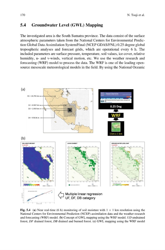
The investigated area is the South Sumatra province. The data consist of the surface
atmospheric parameters taken from the National Centers for Environmental Prediction Global Data Assimilation System/Final (NCEP GDAS/FNL) 0.25 degree global
tropospheric analyses and forecast grids, which are operational every 6 h. The
included parameters are surface pressure, temperature, soil values, ice cover, relative
humidity, u- and v-winds, vertical motion, etc. We use the weather research and
forecasting (WRF) model to process the data. The WRF is one of the leading opensource mesoscale meteorological models in the field. By using the National Oceanic
Fig. 5.4 (a) Near real-time (6 h) monitoring of soil moisture with 1 Â 1 km resolution using the
National Centers for Environmental Prediction (NCEP) assimilation data and the weather research
and forecasting (WRF) model. (b) Concept of GWL mapping using the WRF model. UD undrained
forest, DF drained forest, DB drained and burned forest. (c) GWL mapping using the WRF model
170
N. Tsuji et al.
The investigated area is the South Sumatra province. The data consist of the surface
atmospheric parameters taken from the National Centers for Environmental Prediction Global Data Assimilation System/Final (NCEP GDAS/FNL) 0.25 degree global
tropospheric analyses and forecast grids, which are operational every 6 h. The
included parameters are surface pressure, temperature, soil values, ice cover, relative
humidity, u- and v-winds, vertical motion, etc. We use the weather research and
forecasting (WRF) model to process the data. The WRF is one of the leading opensource mesoscale meteorological models in the field. By using the National Oceanic
Fig. 5.4 (a) Near real-time (6 h) monitoring of soil moisture with 1 Â 1 km resolution using the
National Centers for Environmental Prediction (NCEP) assimilation data and the weather research
and forecasting (WRF) model. (b) Concept of GWL mapping using the WRF model. UD undrained
forest, DF drained forest, DB drained and burned forest. (c) GWL mapping using the WRF model
170
N. Tsuji et al.