

practices, deforestation, land-use changes, etc. by
man induced flood. The main causes of flood in
this study are as follows:
(i) High discharge of water from DVC is one
of the most important factors of flood in
this area (Table 6.1 and Fig. 6.3).
(ii) Heavy rainfall at the Darakeswar–Mundeswari basin area (Table 6.2 and
Fig. 6.4).
(iii) Overflow of water from the Rivers
Mundeswari,
Darakeswar,
KanaDarakeswar, Rupnarayan is one of the
major causes of flood in this area.
(iv) River is severely affected due to sedimentation on river bed. As a result, the
carrying capacity of the rivers decreases
(Plates 6.1, 6.2 and 6.6).
(v) Deforestation in the upper catchment.
(vi) Construction of road, rice mill, brick
industry and embankment on the
floodplain across the natural drainage line
(Plates 6.3 and 6.5).
(vii) Very gentle slope of the River Darakeswar and Mundeswari. The average
slope of the River Darakeswar is
approximately 0.369 meters/km.
(viii) Unwise construction of flood embankment on spill zone of rivers resulting in
deposition of solids in the river bed itself
(heavy siltation).
(ix) Due to inadequate waterways in the road
bridges, accumulation of water on the
upstream.
(x) The administration is not at all alert about
the situation.
(xi) Narrowing of channel width due to agricultural encroachment in some parts of
the lower basin (Plate 6.4).
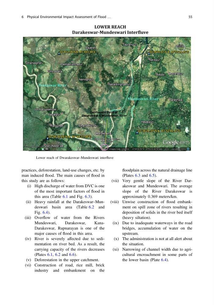
Fig. 6.2 Lower reach of Dwarakeswar–Mundeswari interfluve
6 Physical Environmental Impact Assessment of Flood …
55
man induced flood. The main causes of flood in
this study are as follows:
(i) High discharge of water from DVC is one
of the most important factors of flood in
this area (Table 6.1 and Fig. 6.3).
(ii) Heavy rainfall at the Darakeswar–Mundeswari basin area (Table 6.2 and
Fig. 6.4).
(iii) Overflow of water from the Rivers
Mundeswari,
Darakeswar,
KanaDarakeswar, Rupnarayan is one of the
major causes of flood in this area.
(iv) River is severely affected due to sedimentation on river bed. As a result, the
carrying capacity of the rivers decreases
(Plates 6.1, 6.2 and 6.6).
(v) Deforestation in the upper catchment.
(vi) Construction of road, rice mill, brick
industry and embankment on the
floodplain across the natural drainage line
(Plates 6.3 and 6.5).
(vii) Very gentle slope of the River Darakeswar and Mundeswari. The average
slope of the River Darakeswar is
approximately 0.369 meters/km.
(viii) Unwise construction of flood embankment on spill zone of rivers resulting in
deposition of solids in the river bed itself
(heavy siltation).
(ix) Due to inadequate waterways in the road
bridges, accumulation of water on the
upstream.
(x) The administration is not at all alert about
the situation.
(xi) Narrowing of channel width due to agricultural encroachment in some parts of
the lower basin (Plate 6.4).
Fig. 6.2 Lower reach of Dwarakeswar–Mundeswari interfluve
6 Physical Environmental Impact Assessment of Flood …
55