

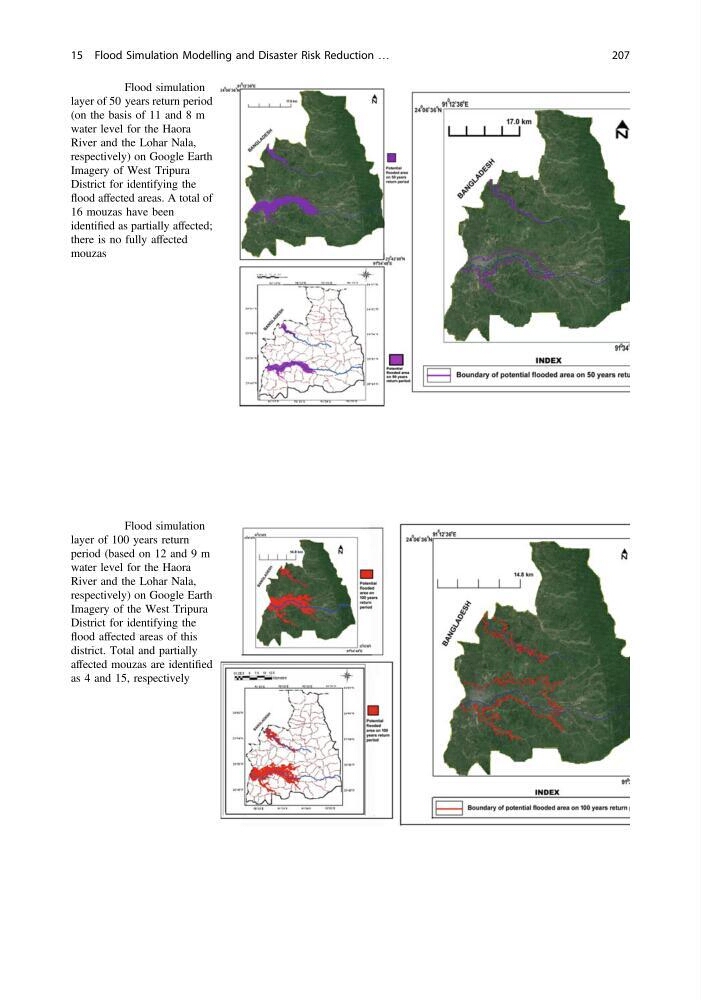
Fig. 15.5 Flood simulation
layer of 50 years return period
(on the basis of 11 and 8 m
water level for the Haora
River and the Lohar Nala,
respectively) on Google Earth
Imagery of West Tripura
District for identifying the
flood affected areas. A total of
16 mouzas have been
identified as partially affected;
there is no fully affected
mouzas
Fig. 15.6 Flood simulation
layer of 100 years return
period (based on 12 and 9 m
water level for the Haora
River and the Lohar Nala,
respectively) on Google Earth
Imagery of the West Tripura
District for identifying the
flood affected areas of this
district. Total and partially
affected mouzas are identified
as 4 and 15, respectively
15 Flood Simulation Modelling and Disaster Risk Reduction …
207
layer of 50 years return period
(on the basis of 11 and 8 m
water level for the Haora
River and the Lohar Nala,
respectively) on Google Earth
Imagery of West Tripura
District for identifying the
flood affected areas. A total of
16 mouzas have been
identified as partially affected;
there is no fully affected
mouzas
Fig. 15.6 Flood simulation
layer of 100 years return
period (based on 12 and 9 m
water level for the Haora
River and the Lohar Nala,
respectively) on Google Earth
Imagery of the West Tripura
District for identifying the
flood affected areas of this
district. Total and partially
affected mouzas are identified
as 4 and 15, respectively
15 Flood Simulation Modelling and Disaster Risk Reduction …
207