

18 Waterways in Poland – The History, Present State and Future
363
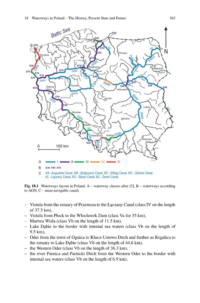
Fig. 18.1 Waterways layout in Poland. A – waterway classes after [5], B – waterways according
to AGN, C – main navigable canals
– Vistula from the estuary of Przemsza to the Ł˛ aczany Canal (class IV on the length
of 37.5 km),
– Vistula from Płock to the Włocławek Dam (class Va for 55 km),
– Martwa Wisła (class Vb on the length of 11.5 km),
– Lake D˛ abie to the border with internal sea waters (class Vb on the length of
9.5 km),
– Oder from the town of Ognica to Klucz-Ustowo Ditch and further as Regalica to
the estuary to Lake D˛ abie (class Vb on the length of 44.6 km),
– the Western Oder (class Vb on the length of 36.3 km),
– the river Parnica and Parnicki Ditch from the Western Oder to the border with
internal sea waters (class Vb on the length of 6.9 km).
363
Fig. 18.1 Waterways layout in Poland. A – waterway classes after [5], B – waterways according
to AGN, C – main navigable canals
– Vistula from the estuary of Przemsza to the Ł˛ aczany Canal (class IV on the length
of 37.5 km),
– Vistula from Płock to the Włocławek Dam (class Va for 55 km),
– Martwa Wisła (class Vb on the length of 11.5 km),
– Lake D˛ abie to the border with internal sea waters (class Vb on the length of
9.5 km),
– Oder from the town of Ognica to Klucz-Ustowo Ditch and further as Regalica to
the estuary to Lake D˛ abie (class Vb on the length of 44.6 km),
– the Western Oder (class Vb on the length of 36.3 km),
– the river Parnica and Parnicki Ditch from the Western Oder to the border with
internal sea waters (class Vb on the length of 6.9 km).