

292
14 Water Resource Allocation and Regulation in Yellow River Basin
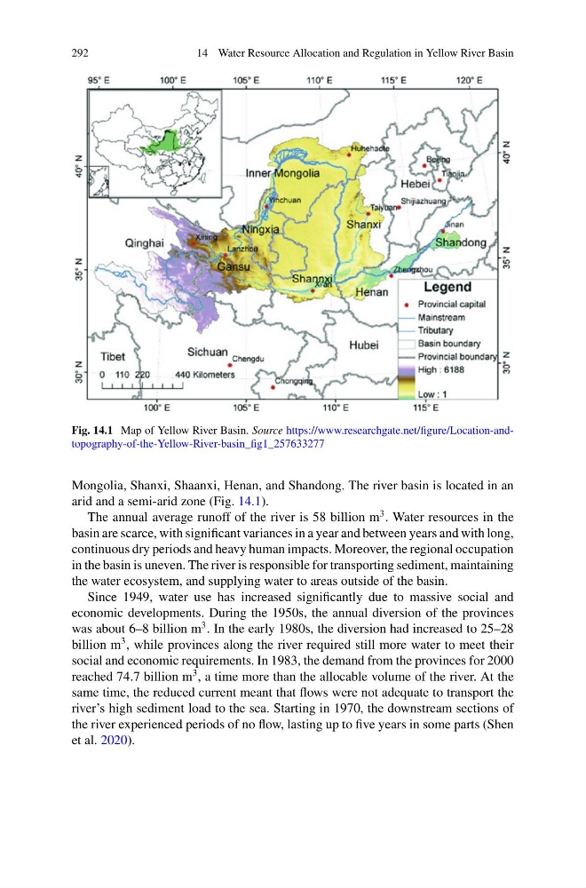
Fig. 14.1 Map of Yellow River Basin. Source https://www.researchgate.net/figure/Location-andtopography-of-the-Yellow-River-basin_fig1_257633277
Mongolia, Shanxi, Shaanxi, Henan, and Shandong. The river basin is located in an
arid and a semi-arid zone (Fig. 14.1).
The annual average runoff of the river is 58 billion m
3 . Water resources in the
basin are scarce, with significant variances in a year and between years and with long,
continuous dry periods and heavy human impacts. Moreover, the regional occupation
in the basin is uneven. The river is responsible for transporting sediment, maintaining
the water ecosystem, and supplying water to areas outside of the basin.
Since 1949, water use has increased significantly due to massive social and
economic developments. During the 1950s, the annual diversion of the provinces
was about 6–8 billion m
3 . In the early 1980s, the diversion had increased to 25–28
billion m
3 , while provinces along the river required still more water to meet their
social and economic requirements. In 1983, the demand from the provinces for 2000
reached 74.7 billion m
3 , a time more than the allocable volume of the river. At the
same time, the reduced current meant that flows were not adequate to transport the
river’s high sediment load to the sea. Starting in 1970, the downstream sections of
the river experienced periods of no flow, lasting up to five years in some parts (Shen
et al. 2020).
14 Water Resource Allocation and Regulation in Yellow River Basin
Fig. 14.1 Map of Yellow River Basin. Source https://www.researchgate.net/figure/Location-andtopography-of-the-Yellow-River-basin_fig1_257633277
Mongolia, Shanxi, Shaanxi, Henan, and Shandong. The river basin is located in an
arid and a semi-arid zone (Fig. 14.1).
The annual average runoff of the river is 58 billion m
3 . Water resources in the
basin are scarce, with significant variances in a year and between years and with long,
continuous dry periods and heavy human impacts. Moreover, the regional occupation
in the basin is uneven. The river is responsible for transporting sediment, maintaining
the water ecosystem, and supplying water to areas outside of the basin.
Since 1949, water use has increased significantly due to massive social and
economic developments. During the 1950s, the annual diversion of the provinces
was about 6–8 billion m
3 . In the early 1980s, the diversion had increased to 25–28
billion m
3 , while provinces along the river required still more water to meet their
social and economic requirements. In 1983, the demand from the provinces for 2000
reached 74.7 billion m
3 , a time more than the allocable volume of the river. At the
same time, the reduced current meant that flows were not adequate to transport the
river’s high sediment load to the sea. Starting in 1970, the downstream sections of
the river experienced periods of no flow, lasting up to five years in some parts (Shen
et al. 2020).