

249
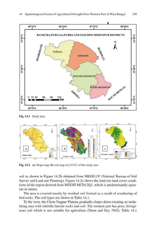
soil as shown in Figure 14.2b obtained from NBSSLUP (National Bureau of Soil
Survey and Land use Planning). Figure 14.2c shows the land use land cover conditions of the region derived from MODIS MCD12Q1, which is predominantly agrarian in nature.
The area is covered mostly by residual soil formed as a result of weathering of
bed rocks. The soil types are shown in Table 14.1.
To the west, the Chota Nagpur Plateau gradually slopes down creating an undulating area with infertile laterite rocks and soil. The western part has poor, ferruginous soil which is not suitable for agriculture (Dunn and Dey 1942). Table 14.1
Fig. 14.1 Study area
Fig. 14.2 (a) Slope map (b) soil map (c) LULC of the study area
14 Spatiotemporal Extent of Agricultural Drought Over Western Part of West Bengal
soil as shown in Figure 14.2b obtained from NBSSLUP (National Bureau of Soil
Survey and Land use Planning). Figure 14.2c shows the land use land cover conditions of the region derived from MODIS MCD12Q1, which is predominantly agrarian in nature.
The area is covered mostly by residual soil formed as a result of weathering of
bed rocks. The soil types are shown in Table 14.1.
To the west, the Chota Nagpur Plateau gradually slopes down creating an undulating area with infertile laterite rocks and soil. The western part has poor, ferruginous soil which is not suitable for agriculture (Dunn and Dey 1942). Table 14.1
Fig. 14.1 Study area
Fig. 14.2 (a) Slope map (b) soil map (c) LULC of the study area
14 Spatiotemporal Extent of Agricultural Drought Over Western Part of West Bengal