

215
Sundarban in the perspective of climate change (Rudra and Haldar 2017). In 2009
alone, the cyclone Aila devastated about 1000 km of embankments across the
Sundarban. Erosion and loss of mangrove were the other factors reshaping the
coastline in the area. It may be pointed out that since 2009 many severe cyclones
(e.g. Bijli in 2009, Aila in 2009, Laila in 2010, Hudhud in 2014, Roanu in 2016, Titli
in 2018, Fani in 2019) and associated phenomena, such as storm surge, high intensity storms and rainfall, bank erosion, etc., continuously hamper people’s living and
increasing displacement of human, as in Ghoramara. Since 2000, water level in the
Bay of Bengal has been rising at the rate of about 6.5 mm (0.2 inches) annually
(Jana et al. 2012; Hazra 2010). Thus, around 50,000 people left the island to become
labourers in distant places of India, and there is no official documentation on how
many actually left the island.
Over the years, Kamalpur and Colony number III, known as the Jibantala rehabilitation colony, in Sagar Island became home to many of the climate-affected
migrants from Ghoramara and Lohachara islands, where people have been given an
opportunity of rebuilding their lives. Around 1977, the then Government of West
Bengal after creation of the resettlement plots declared Ghoramara island as a ‘No
man’s land’, which meant the government would no longer take any responsibility
for construction of embankments or provide other support services like health,
drinking water and education – despite the fact that around 5000 people still inhabited in the island (Peth 2014). The State did not recognize the climate induced
migrants and the displaced population as refugee, nor did they get benefits from the
local administration.
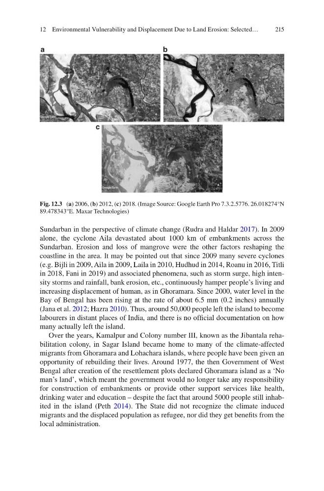
Fig. 12.3 (a) 2006, (b) 2012, (c) 2018. (Image Source: Google Earth Pro 7.3.2.5776. 26.018274°N
89.478343°E. Maxar Technologies)
12 Environmental Vulnerability and Displacement Due to Land Erosion: Selected…
Sundarban in the perspective of climate change (Rudra and Haldar 2017). In 2009
alone, the cyclone Aila devastated about 1000 km of embankments across the
Sundarban. Erosion and loss of mangrove were the other factors reshaping the
coastline in the area. It may be pointed out that since 2009 many severe cyclones
(e.g. Bijli in 2009, Aila in 2009, Laila in 2010, Hudhud in 2014, Roanu in 2016, Titli
in 2018, Fani in 2019) and associated phenomena, such as storm surge, high intensity storms and rainfall, bank erosion, etc., continuously hamper people’s living and
increasing displacement of human, as in Ghoramara. Since 2000, water level in the
Bay of Bengal has been rising at the rate of about 6.5 mm (0.2 inches) annually
(Jana et al. 2012; Hazra 2010). Thus, around 50,000 people left the island to become
labourers in distant places of India, and there is no official documentation on how
many actually left the island.
Over the years, Kamalpur and Colony number III, known as the Jibantala rehabilitation colony, in Sagar Island became home to many of the climate-affected
migrants from Ghoramara and Lohachara islands, where people have been given an
opportunity of rebuilding their lives. Around 1977, the then Government of West
Bengal after creation of the resettlement plots declared Ghoramara island as a ‘No
man’s land’, which meant the government would no longer take any responsibility
for construction of embankments or provide other support services like health,
drinking water and education – despite the fact that around 5000 people still inhabited in the island (Peth 2014). The State did not recognize the climate induced
migrants and the displaced population as refugee, nor did they get benefits from the
local administration.
Fig. 12.3 (a) 2006, (b) 2012, (c) 2018. (Image Source: Google Earth Pro 7.3.2.5776. 26.018274°N
89.478343°E. Maxar Technologies)
12 Environmental Vulnerability and Displacement Due to Land Erosion: Selected…