

212
major concern for the char (shoal/ sand bar) dwellers of the surrounding villages.
Heavy sedimentation from the Himalayan foothills causes increase in river load and
results in floods in the lower plains. Gitaldaha village experiences this particular
phenomenon about twice a year. The precise location of the present re-settlers is
near Dakshin Kharija Gitaldaha who has shifted more than 2 km from their previous
dwellings in the last 10 years. Total geographical area of Dakshin Kharija Gitaldaha
village is about 1.49 km
2
. Population density of the village is 1736 persons per km
2
.
Presently the population of Kharija Gitaldaha village is 2587 with 47% women and
617 households. Of 874 workers engaged in Main Work, 304 were cultivators
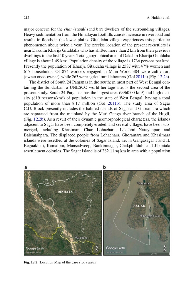
(owner or co-owner), while 263 were agricultural labourers (GoI 2011a) (Fig. 12.2a).
The district of South 24 Parganas in the southern most part of West Bengal containing the Sundarban, a UNESCO world heritage site, is the second area of the
present study. South 24 Parganas has the largest area (9960.00 km
2
) and high density (819 persons/km
2
) of population in the state of West Bengal, having a total
population of more than 8.17 million (GoI 2011b). The study area of Sagar
C.D. Block presently includes the habited islands of Sagar and Ghoramara which
are separated from the mainland by the Muri Ganga river branch of the Hugli,
(Fig. 12.2b). As a result of their dynamic geomorphological characters, the islands
adjacent to Sagar have been completely eroded, and several villages have been submerged, including Khasimara Char, Lohachara, Lakshmi Narayanpur, and
Baishnabpara. The displaced people from Lohachara, Ghoramara and Khasimara
islands were resettled at the colonies of Sagar Island, i.e. in Gangasagar I and II,
Beguakhali, Kamalpur, Mansadweep, Bankimnagar, Chakphuldubi and Jibantala
resettlement colonies. The Sagar Island is of 282.11 sq.km in area with a population
Fig. 12.2 Location Map of the case study areas
A. Haldar et al.
major concern for the char (shoal/ sand bar) dwellers of the surrounding villages.
Heavy sedimentation from the Himalayan foothills causes increase in river load and
results in floods in the lower plains. Gitaldaha village experiences this particular
phenomenon about twice a year. The precise location of the present re-settlers is
near Dakshin Kharija Gitaldaha who has shifted more than 2 km from their previous
dwellings in the last 10 years. Total geographical area of Dakshin Kharija Gitaldaha
village is about 1.49 km
2
. Population density of the village is 1736 persons per km
2
.
Presently the population of Kharija Gitaldaha village is 2587 with 47% women and
617 households. Of 874 workers engaged in Main Work, 304 were cultivators
(owner or co-owner), while 263 were agricultural labourers (GoI 2011a) (Fig. 12.2a).
The district of South 24 Parganas in the southern most part of West Bengal containing the Sundarban, a UNESCO world heritage site, is the second area of the
present study. South 24 Parganas has the largest area (9960.00 km
2
) and high density (819 persons/km
2
) of population in the state of West Bengal, having a total
population of more than 8.17 million (GoI 2011b). The study area of Sagar
C.D. Block presently includes the habited islands of Sagar and Ghoramara which
are separated from the mainland by the Muri Ganga river branch of the Hugli,
(Fig. 12.2b). As a result of their dynamic geomorphological characters, the islands
adjacent to Sagar have been completely eroded, and several villages have been submerged, including Khasimara Char, Lohachara, Lakshmi Narayanpur, and
Baishnabpara. The displaced people from Lohachara, Ghoramara and Khasimara
islands were resettled at the colonies of Sagar Island, i.e. in Gangasagar I and II,
Beguakhali, Kamalpur, Mansadweep, Bankimnagar, Chakphuldubi and Jibantala
resettlement colonies. The Sagar Island is of 282.11 sq.km in area with a population
Fig. 12.2 Location Map of the case study areas
A. Haldar et al.