

The Formal- Informal Street Grid [CP11]
Relation to other Core Patterns:
CP10, CP14, CP23
Alignment to Generative code:
[GC3] Diagnosis of Settlement
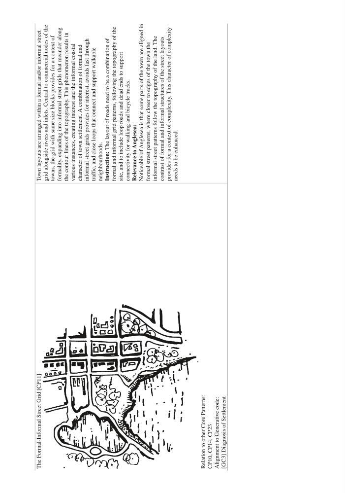
Town layouts are arranged within a formal and/or informal street
grid alongside rivers and inlets. Central to commercial nodes of the
towns, the grid with same size blocks provides for a context of
formality, expanding into informal street grids that meander along
the contour lines of the topography. This phenomenon results in
various instances, creating interest and the informal coastal
character of town settlement. A combination of formal and
informal street grids provides for interest, avoids fast through
traffic, and close loops that connect and support walkable
neighbourhoods.
Instruction: The layout of roads need to be a combination of
formal and informal grid patterns, following the topography of the
site, and to include loop roads and dead ends to support
connectivity for walking and bicycle tracks.
Relevance to Anglesea:
Noticeable of Anglesea is that some parts of the town are aligned in
formal street patterns, where closer to edges of the town the
informal street patterns follow the topography of the land. The
contrast of formal and informal structures of the street layouts
provides for a context of complexity. This character of complexity
needs to be enhanced.
Relation to other Core Patterns:
CP10, CP14, CP23
Alignment to Generative code:
[GC3] Diagnosis of Settlement
Town layouts are arranged within a formal and/or informal street
grid alongside rivers and inlets. Central to commercial nodes of the
towns, the grid with same size blocks provides for a context of
formality, expanding into informal street grids that meander along
the contour lines of the topography. This phenomenon results in
various instances, creating interest and the informal coastal
character of town settlement. A combination of formal and
informal street grids provides for interest, avoids fast through
traffic, and close loops that connect and support walkable
neighbourhoods.
Instruction: The layout of roads need to be a combination of
formal and informal grid patterns, following the topography of the
site, and to include loop roads and dead ends to support
connectivity for walking and bicycle tracks.
Relevance to Anglesea:
Noticeable of Anglesea is that some parts of the town are aligned in
formal street patterns, where closer to edges of the town the
informal street patterns follow the topography of the land. The
contrast of formal and informal structures of the street layouts
provides for a context of complexity. This character of complexity
needs to be enhanced.