

175
Table 11.3 (continued)
Generative Code:
[GC4] Potential of Settlement
Explanation:
The settlements are exposed to future changes in climate as well as population growth. The growth of the towns
will be more exposed to the risks of climate change impacts such as increased heat and more frequent bush fires,
inundation by sea level rise, floods and coastal recession. The sustainable future of these towns are rooted in their
connections to the environment, in a social, environmental and economic context. The potential of settlements can
be identified and can be expressed in regenerative-adaptive design and planning outcomes. Potential of place
indicates what is unique to it that can contribute to the wholeness of the larger system of which it is part for the
future resilience that can be established through its core patterns, attributes and values. This Generative Code aims
to identify those core patterns, values and attributes that will provide the place’s potential for future resilience.
Statement:
Identify the potential of place that indicates what is unique to the settlement that has the potential to contribute to
the wholeness of the larger system of which it is part, and the sustainable future of place to secure resilience in a
future changed environment.
Core Patterns Aligned:
At the Heart [CP20], Meeting Place [CP26], Tread Lightly [CP21], House Mix [CP22], Sense of Danger [CP25]
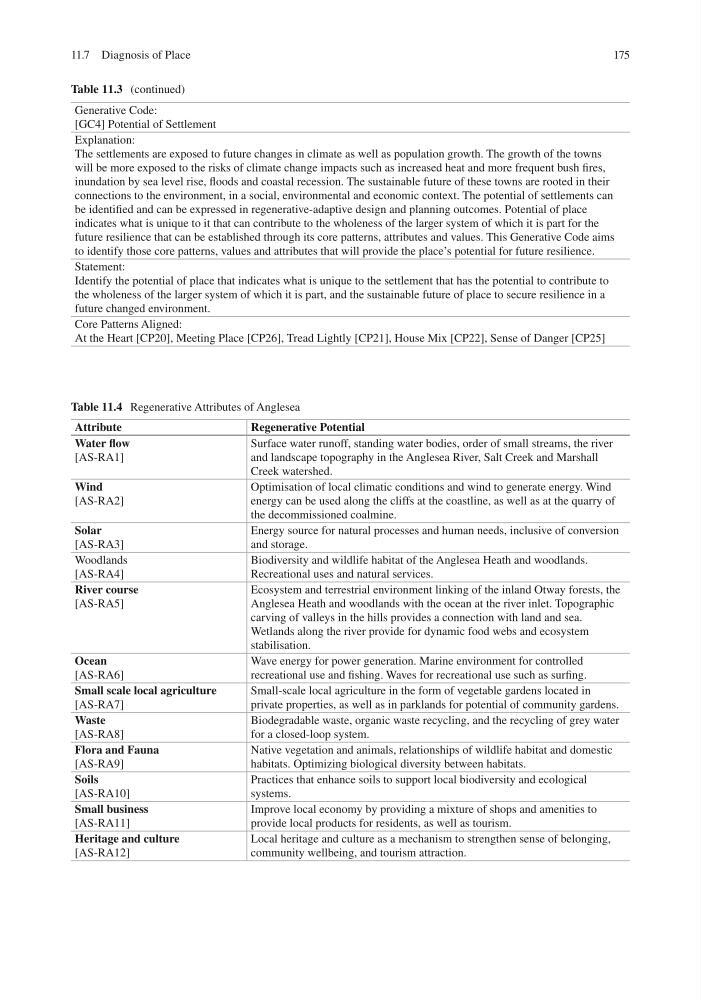
Table 11.4 Regenerative Attributes of Anglesea
Attribute
Regenerative Potential
Water flow
[AS-RA1]
Surface water runoff, standing water bodies, order of small streams, the river
and landscape topography in the Anglesea River, Salt Creek and Marshall
Creek watershed.
Wind
[AS-RA2]
Optimisation of local climatic conditions and wind to generate energy. Wind
energy can be used along the cliffs at the coastline, as well as at the quarry of
the decommissioned coalmine.
Solar
[AS-RA3]
Energy source for natural processes and human needs, inclusive of conversion
and storage.
Woodlands
[AS-RA4]
Biodiversity and wildlife habitat of the Anglesea Heath and woodlands.
Recreational uses and natural services.
River course
[AS-RA5]
Ecosystem and terrestrial environment linking of the inland Otway forests, the
Anglesea Heath and woodlands with the ocean at the river inlet. Topographic
carving of valleys in the hills provides a connection with land and sea.
Wetlands along the river provide for dynamic food webs and ecosystem
stabilisation.
Ocean
[AS-RA6]
Wave energy for power generation. Marine environment for controlled
recreational use and fishing. Waves for recreational use such as surfing.
Small scale local agriculture
[AS-RA7]
Small-scale local agriculture in the form of vegetable gardens located in
private properties, as well as in parklands for potential of community gardens.
Waste
[AS-RA8]
Biodegradable waste, organic waste recycling, and the recycling of grey water
for a closed-loop system.
Flora and Fauna
[AS-RA9]
Native vegetation and animals, relationships of wildlife habitat and domestic
habitats. Optimizing biological diversity between habitats.
Soils
[AS-RA10]
Practices that enhance soils to support local biodiversity and ecological
systems.
Small business
[AS-RA11]
Improve local economy by providing a mixture of shops and amenities to
provide local products for residents, as well as tourism.
Heritage and culture
[AS-RA12]
Local heritage and culture as a mechanism to strengthen sense of belonging,
community wellbeing, and tourism attraction.
11.7 Diagnosis of Place
Table 11.3 (continued)
Generative Code:
[GC4] Potential of Settlement
Explanation:
The settlements are exposed to future changes in climate as well as population growth. The growth of the towns
will be more exposed to the risks of climate change impacts such as increased heat and more frequent bush fires,
inundation by sea level rise, floods and coastal recession. The sustainable future of these towns are rooted in their
connections to the environment, in a social, environmental and economic context. The potential of settlements can
be identified and can be expressed in regenerative-adaptive design and planning outcomes. Potential of place
indicates what is unique to it that can contribute to the wholeness of the larger system of which it is part for the
future resilience that can be established through its core patterns, attributes and values. This Generative Code aims
to identify those core patterns, values and attributes that will provide the place’s potential for future resilience.
Statement:
Identify the potential of place that indicates what is unique to the settlement that has the potential to contribute to
the wholeness of the larger system of which it is part, and the sustainable future of place to secure resilience in a
future changed environment.
Core Patterns Aligned:
At the Heart [CP20], Meeting Place [CP26], Tread Lightly [CP21], House Mix [CP22], Sense of Danger [CP25]
Table 11.4 Regenerative Attributes of Anglesea
Attribute
Regenerative Potential
Water flow
[AS-RA1]
Surface water runoff, standing water bodies, order of small streams, the river
and landscape topography in the Anglesea River, Salt Creek and Marshall
Creek watershed.
Wind
[AS-RA2]
Optimisation of local climatic conditions and wind to generate energy. Wind
energy can be used along the cliffs at the coastline, as well as at the quarry of
the decommissioned coalmine.
Solar
[AS-RA3]
Energy source for natural processes and human needs, inclusive of conversion
and storage.
Woodlands
[AS-RA4]
Biodiversity and wildlife habitat of the Anglesea Heath and woodlands.
Recreational uses and natural services.
River course
[AS-RA5]
Ecosystem and terrestrial environment linking of the inland Otway forests, the
Anglesea Heath and woodlands with the ocean at the river inlet. Topographic
carving of valleys in the hills provides a connection with land and sea.
Wetlands along the river provide for dynamic food webs and ecosystem
stabilisation.
Ocean
[AS-RA6]
Wave energy for power generation. Marine environment for controlled
recreational use and fishing. Waves for recreational use such as surfing.
Small scale local agriculture
[AS-RA7]
Small-scale local agriculture in the form of vegetable gardens located in
private properties, as well as in parklands for potential of community gardens.
Waste
[AS-RA8]
Biodegradable waste, organic waste recycling, and the recycling of grey water
for a closed-loop system.
Flora and Fauna
[AS-RA9]
Native vegetation and animals, relationships of wildlife habitat and domestic
habitats. Optimizing biological diversity between habitats.
Soils
[AS-RA10]
Practices that enhance soils to support local biodiversity and ecological
systems.
Small business
[AS-RA11]
Improve local economy by providing a mixture of shops and amenities to
provide local products for residents, as well as tourism.
Heritage and culture
[AS-RA12]
Local heritage and culture as a mechanism to strengthen sense of belonging,
community wellbeing, and tourism attraction.
11.7 Diagnosis of Place