

9
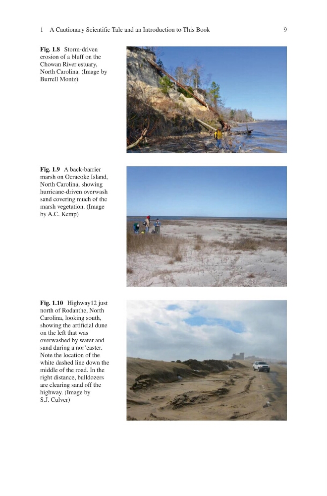
Fig. 1.8 Storm-driven
erosion of a bluff on the
Chowan River estuary,
North Carolina. (Image by
Burrell Montz)
Fig. 1.9 A back-barrier
marsh on Ocracoke Island,
North Carolina, showing
hurricane-driven overwash
sand covering much of the
marsh vegetation. (Image
by A.C. Kemp)
Fig. 1.10 Highway12 just
north of Rodanthe, North
Carolina, looking south,
showing the artificial dune
on the left that was
overwashed by water and
sand during a nor’easter.
Note the location of the
white dashed line down the
middle of the road. In the
right distance, bulldozers
are clearing sand off the
highway. (Image by
S.J. Culver)
1 A Cautionary Scientific Tale and an Introduction to This Book
Fig. 1.8 Storm-driven
erosion of a bluff on the
Chowan River estuary,
North Carolina. (Image by
Burrell Montz)
Fig. 1.9 A back-barrier
marsh on Ocracoke Island,
North Carolina, showing
hurricane-driven overwash
sand covering much of the
marsh vegetation. (Image
by A.C. Kemp)
Fig. 1.10 Highway12 just
north of Rodanthe, North
Carolina, looking south,
showing the artificial dune
on the left that was
overwashed by water and
sand during a nor’easter.
Note the location of the
white dashed line down the
middle of the road. In the
right distance, bulldozers
are clearing sand off the
highway. (Image by
S.J. Culver)
1 A Cautionary Scientific Tale and an Introduction to This Book