

215
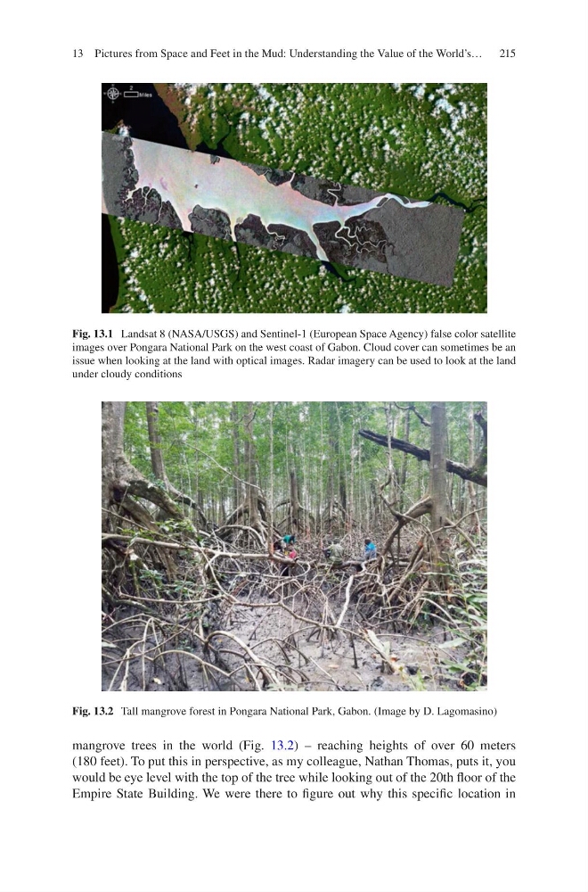
mangrove trees in the world (Fig. 13.2) – reaching heights of over 60 meters
(180 feet). To put this in perspective, as my colleague, Nathan Thomas, puts it, you
would be eye level with the top of the tree while looking out of the 20th floor of the
Empire State Building. We were there to figure out why this specific location in
Fig. 13.1 Landsat 8 (NASA/USGS) and Sentinel-1 (European Space Agency) false color satellite
images over Pongara National Park on the west coast of Gabon. Cloud cover can sometimes be an
issue when looking at the land with optical images. Radar imagery can be used to look at the land
under cloudy conditions
Fig. 13.2 Tall mangrove forest in Pongara National Park, Gabon. (Image by D. Lagomasino)
13 Pictures from Space and Feet in the Mud: Understanding the Value of the World’s…
mangrove trees in the world (Fig. 13.2) – reaching heights of over 60 meters
(180 feet). To put this in perspective, as my colleague, Nathan Thomas, puts it, you
would be eye level with the top of the tree while looking out of the 20th floor of the
Empire State Building. We were there to figure out why this specific location in
Fig. 13.1 Landsat 8 (NASA/USGS) and Sentinel-1 (European Space Agency) false color satellite
images over Pongara National Park on the west coast of Gabon. Cloud cover can sometimes be an
issue when looking at the land with optical images. Radar imagery can be used to look at the land
under cloudy conditions
Fig. 13.2 Tall mangrove forest in Pongara National Park, Gabon. (Image by D. Lagomasino)
13 Pictures from Space and Feet in the Mud: Understanding the Value of the World’s…