

180
days on end. For 6 years we watched, mapped, measured, and became intimately
familiar with the many moods and predilections of the dragon. She not only seemed
to have a real personality, but she became an understandable organism that had
order and reason – in other words, it was a true inlet/outlet system.
Barrier Islands and Inlet/Outlet Systems
My understanding of North Carolina’s Outer Banks and associated inlet/outlet systems began with the intimate relationship developed during the most memorable
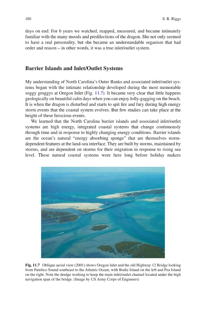
soggy groggys at Oregon Inlet (Fig. 11.7). It became very clear that little happens
geologically on beautiful calm days when you can enjoy lolly-gagging on the beach.
It is when the dragon is disturbed and starts to spit fire and fury during high energy
storm events that the coastal system evolves. But few studies can take place at the
height of these ferocious events.
We learned that the North Carolina barrier islands and associated inlet/outlet
systems are high energy, integrated coastal systems that change continuously
through time and in response to highly changing energy conditions. Barrier islands
are the ocean’s natural “energy absorbing sponge” that are themselves stormdependent features at the land-sea interface. They are built by storms, maintained by
storms, and are dependent on storms for their migration in response to rising sea
level. These natural coastal systems were here long before holiday makers
Fig. 11.7 Oblique aerial view (2001) shows Oregon Inlet and the old Highway 12 Bridge looking
from Pamlico Sound southeast to the Atlantic Ocean, with Bodie Island on the left and Pea Island
on the right. Note the dredge working to keep the main inlet/outlet channel located under the high
navigation span of the bridge. (Image by US Army Corps of Engineers)
S. R. Riggs
days on end. For 6 years we watched, mapped, measured, and became intimately
familiar with the many moods and predilections of the dragon. She not only seemed
to have a real personality, but she became an understandable organism that had
order and reason – in other words, it was a true inlet/outlet system.
Barrier Islands and Inlet/Outlet Systems
My understanding of North Carolina’s Outer Banks and associated inlet/outlet systems began with the intimate relationship developed during the most memorable
soggy groggys at Oregon Inlet (Fig. 11.7). It became very clear that little happens
geologically on beautiful calm days when you can enjoy lolly-gagging on the beach.
It is when the dragon is disturbed and starts to spit fire and fury during high energy
storm events that the coastal system evolves. But few studies can take place at the
height of these ferocious events.
We learned that the North Carolina barrier islands and associated inlet/outlet
systems are high energy, integrated coastal systems that change continuously
through time and in response to highly changing energy conditions. Barrier islands
are the ocean’s natural “energy absorbing sponge” that are themselves stormdependent features at the land-sea interface. They are built by storms, maintained by
storms, and are dependent on storms for their migration in response to rising sea
level. These natural coastal systems were here long before holiday makers
Fig. 11.7 Oblique aerial view (2001) shows Oregon Inlet and the old Highway 12 Bridge looking
from Pamlico Sound southeast to the Atlantic Ocean, with Bodie Island on the left and Pea Island
on the right. Note the dredge working to keep the main inlet/outlet channel located under the high
navigation span of the bridge. (Image by US Army Corps of Engineers)
S. R. Riggs