

130
An Exciting Interlude
Installing monitoring wells, deploying loggers and collecting data in the reserve and
surface water bodies was an adventure unto itself. To understand the interactions
between the surface water and groundwater regimes, my research team has installed
and instrumented shallow groundwater monitoring stations (i.e., wells deployed in
groundwater and surface water) in various locations in the Emily and Richardson
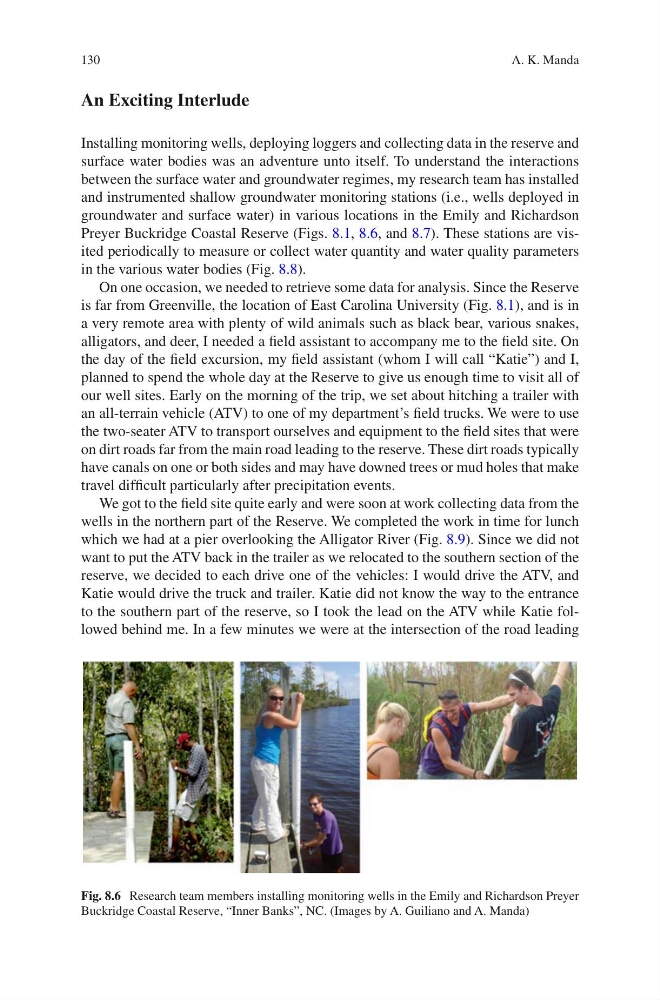
Preyer Buckridge Coastal Reserve (Figs. 8.1, 8.6, and 8.7). These stations are visited periodically to measure or collect water quantity and water quality parameters
in the various water bodies (Fig. 8.8).
On one occasion, we needed to retrieve some data for analysis. Since the Reserve
is far from Greenville, the location of East Carolina University (Fig. 8.1), and is in
a very remote area with plenty of wild animals such as black bear, various snakes,
alligators, and deer, I needed a field assistant to accompany me to the field site. On
the day of the field excursion, my field assistant (whom I will call “Katie”) and I,
planned to spend the whole day at the Reserve to give us enough time to visit all of
our well sites. Early on the morning of the trip, we set about hitching a trailer with
an all-terrain vehicle (ATV) to one of my department’s field trucks. We were to use
the two-seater ATV to transport ourselves and equipment to the field sites that were
on dirt roads far from the main road leading to the reserve. These dirt roads typically
have canals on one or both sides and may have downed trees or mud holes that make
travel difficult particularly after precipitation events.
We got to the field site quite early and were soon at work collecting data from the
wells in the northern part of the Reserve. We completed the work in time for lunch
which we had at a pier overlooking the Alligator River (Fig. 8.9). Since we did not
want to put the ATV back in the trailer as we relocated to the southern section of the
reserve, we decided to each drive one of the vehicles: I would drive the ATV, and
Katie would drive the truck and trailer. Katie did not know the way to the entrance
to the southern part of the reserve, so I took the lead on the ATV while Katie followed behind me. In a few minutes we were at the intersection of the road leading
Fig. 8.6 Research team members installing monitoring wells in the Emily and Richardson Preyer
Buckridge Coastal Reserve, “Inner Banks”, NC. (Images by A. Guiliano and A. Manda)
A. K. Manda
An Exciting Interlude
Installing monitoring wells, deploying loggers and collecting data in the reserve and
surface water bodies was an adventure unto itself. To understand the interactions
between the surface water and groundwater regimes, my research team has installed
and instrumented shallow groundwater monitoring stations (i.e., wells deployed in
groundwater and surface water) in various locations in the Emily and Richardson
Preyer Buckridge Coastal Reserve (Figs. 8.1, 8.6, and 8.7). These stations are visited periodically to measure or collect water quantity and water quality parameters
in the various water bodies (Fig. 8.8).
On one occasion, we needed to retrieve some data for analysis. Since the Reserve
is far from Greenville, the location of East Carolina University (Fig. 8.1), and is in
a very remote area with plenty of wild animals such as black bear, various snakes,
alligators, and deer, I needed a field assistant to accompany me to the field site. On
the day of the field excursion, my field assistant (whom I will call “Katie”) and I,
planned to spend the whole day at the Reserve to give us enough time to visit all of
our well sites. Early on the morning of the trip, we set about hitching a trailer with
an all-terrain vehicle (ATV) to one of my department’s field trucks. We were to use
the two-seater ATV to transport ourselves and equipment to the field sites that were
on dirt roads far from the main road leading to the reserve. These dirt roads typically
have canals on one or both sides and may have downed trees or mud holes that make
travel difficult particularly after precipitation events.
We got to the field site quite early and were soon at work collecting data from the
wells in the northern part of the Reserve. We completed the work in time for lunch
which we had at a pier overlooking the Alligator River (Fig. 8.9). Since we did not
want to put the ATV back in the trailer as we relocated to the southern section of the
reserve, we decided to each drive one of the vehicles: I would drive the ATV, and
Katie would drive the truck and trailer. Katie did not know the way to the entrance
to the southern part of the reserve, so I took the lead on the ATV while Katie followed behind me. In a few minutes we were at the intersection of the road leading
Fig. 8.6 Research team members installing monitoring wells in the Emily and Richardson Preyer
Buckridge Coastal Reserve, “Inner Banks”, NC. (Images by A. Guiliano and A. Manda)
A. K. Manda