

95
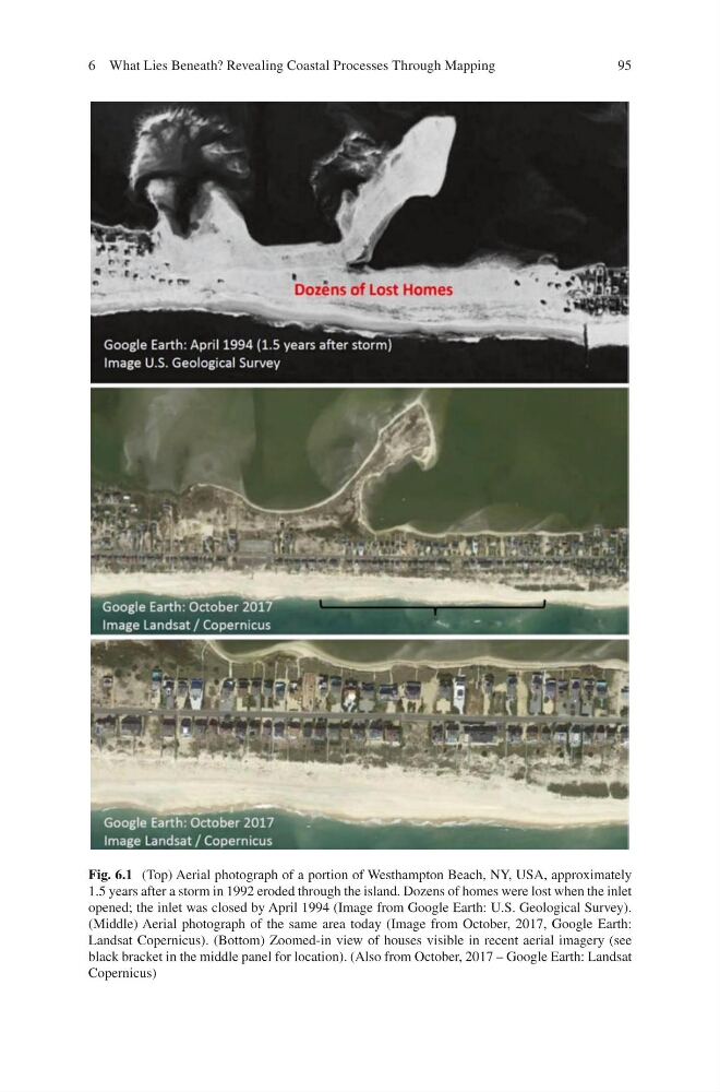
Fig. 6.1 (Top) Aerial photograph of a portion of Westhampton Beach, NY, USA, approximately
1.5 years after a storm in 1992 eroded through the island. Dozens of homes were lost when the inlet
opened; the inlet was closed by April 1994 (Image from Google Earth: U.S. Geological Survey).
(Middle) Aerial photograph of the same area today (Image from October, 2017, Google Earth:
Landsat Copernicus). (Bottom) Zoomed-in view of houses visible in recent aerial imagery (see
black bracket in the middle panel for location). (Also from October, 2017 – Google Earth: Landsat
Copernicus)
6 What Lies Beneath? Revealing Coastal Processes Through Mapping
Fig. 6.1 (Top) Aerial photograph of a portion of Westhampton Beach, NY, USA, approximately
1.5 years after a storm in 1992 eroded through the island. Dozens of homes were lost when the inlet
opened; the inlet was closed by April 1994 (Image from Google Earth: U.S. Geological Survey).
(Middle) Aerial photograph of the same area today (Image from October, 2017, Google Earth:
Landsat Copernicus). (Bottom) Zoomed-in view of houses visible in recent aerial imagery (see
black bracket in the middle panel for location). (Also from October, 2017 – Google Earth: Landsat
Copernicus)
6 What Lies Beneath? Revealing Coastal Processes Through Mapping