

12
2 Geography of Transboundary River Basins
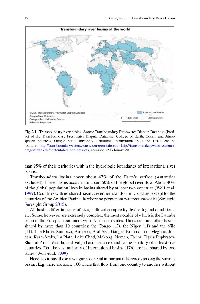
Fig. 2.1 Transboundary river basins. Source Transboundary Freshwater Dispute Database (Product of the Transboundary Freshwater Dispute Database, College of Earth, Ocean, and Atmospheric Sciences, Oregon State University. Additional information about the TFDD can be
found at: http://transboundarywaters.science.oregonstate.edu) http://transboundarywaters.science.
oregonstate.edu/content/data-and-datasets, accessed 12 February 2019
than 95% of their territories within the hydrologic boundaries of international river
basins.
Transboundary basins cover about 47% of the Earth’s surface (Antarctica
excluded). These basins account for about 60% of the global river flow. About 40%
of the global population lives in basins shared by at least two countries (Wolf et al.
1999). Countries with no shared basins are either islands or microstates, except for the
countries of the Arabian Peninsula where no permanent watercourses exist (Strategic
Foresight Group 2015).
All basins differ in terms of size, political complexity, hydro-logical conditions,
etc. Some, however, are extremely complex, the most notable of which is the Danube
basin in the European continent with 19 riparian states. There are three other basins
shared by more than 10 countries: the Congo (13), the Niger (11) and the Nile
(11). The Rhine, Zambezi, Amazon, Aral Sea, Ganges-Brahmaputra-Meghna, Jordan, Kura-Araks, La Plata, Lake Chad, Mekong, Neman, Tarim, Tigris-EuphratesShatt al Arab, Vistula, and Volga basins each extend to the territory of at least five
countries. Yet, the vast majority of international basins (176) are just shared by two
states (Wolf et al. 1999).
Needless to say, these raw figures conceal important differences among the various
basins. E.g. there are some 100 rivers that flow from one country to another without
2 Geography of Transboundary River Basins
Fig. 2.1 Transboundary river basins. Source Transboundary Freshwater Dispute Database (Product of the Transboundary Freshwater Dispute Database, College of Earth, Ocean, and Atmospheric Sciences, Oregon State University. Additional information about the TFDD can be
found at: http://transboundarywaters.science.oregonstate.edu) http://transboundarywaters.science.
oregonstate.edu/content/data-and-datasets, accessed 12 February 2019
than 95% of their territories within the hydrologic boundaries of international river
basins.
Transboundary basins cover about 47% of the Earth’s surface (Antarctica
excluded). These basins account for about 60% of the global river flow. About 40%
of the global population lives in basins shared by at least two countries (Wolf et al.
1999). Countries with no shared basins are either islands or microstates, except for the
countries of the Arabian Peninsula where no permanent watercourses exist (Strategic
Foresight Group 2015).
All basins differ in terms of size, political complexity, hydro-logical conditions,
etc. Some, however, are extremely complex, the most notable of which is the Danube
basin in the European continent with 19 riparian states. There are three other basins
shared by more than 10 countries: the Congo (13), the Niger (11) and the Nile
(11). The Rhine, Zambezi, Amazon, Aral Sea, Ganges-Brahmaputra-Meghna, Jordan, Kura-Araks, La Plata, Lake Chad, Mekong, Neman, Tarim, Tigris-EuphratesShatt al Arab, Vistula, and Volga basins each extend to the territory of at least five
countries. Yet, the vast majority of international basins (176) are just shared by two
states (Wolf et al. 1999).
Needless to say, these raw figures conceal important differences among the various
basins. E.g. there are some 100 rivers that flow from one country to another without