

In this form of modeling, a modeler builds a statistical prediction model from
available data through regression analysis. This type of modeling has been used to
predict processes like flooding, groundwater contamination, and soil loss.
Network analysis allows GIS users to solve a variety of problems using geographic networks (rivers, pipelines, streets, highways, etc.).
-
=
Landsat TM : April 20, 2001
Landsat ETM : March 2, 2000
Wet Polygon Layer in Floodplain
March 2, 2000
Wet Polygon Layer in Floodplain
April 20, 2001
Polygon on Polygon Overlay
On Landsat ETM Background
Digitization
of wet areas
Digitization
of wet areas
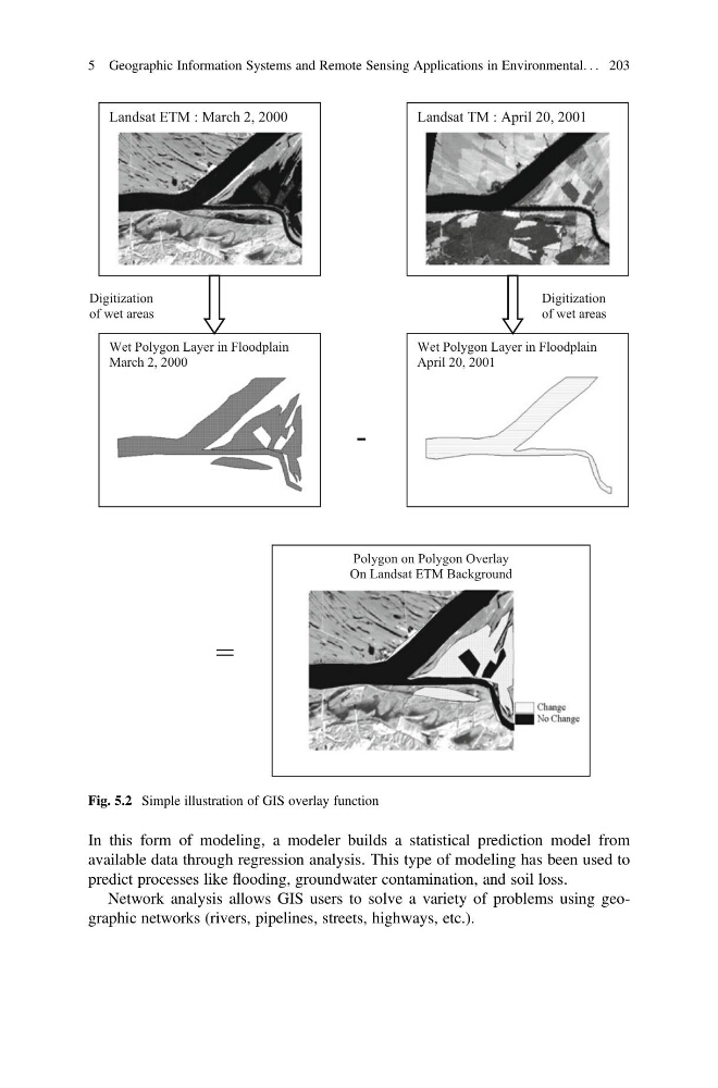
Fig. 5.2 Simple illustration of GIS overlay function
5 Geographic Information Systems and Remote Sensing Applications in Environmental. . . 203
available data through regression analysis. This type of modeling has been used to
predict processes like flooding, groundwater contamination, and soil loss.
Network analysis allows GIS users to solve a variety of problems using geographic networks (rivers, pipelines, streets, highways, etc.).
-
=
Landsat TM : April 20, 2001
Landsat ETM : March 2, 2000
Wet Polygon Layer in Floodplain
March 2, 2000
Wet Polygon Layer in Floodplain
April 20, 2001
Polygon on Polygon Overlay
On Landsat ETM Background
Digitization
of wet areas
Digitization
of wet areas
Fig. 5.2 Simple illustration of GIS overlay function
5 Geographic Information Systems and Remote Sensing Applications in Environmental. . . 203