

3 Disruptive Mobility in Pre- and Post-COVID Times …
71
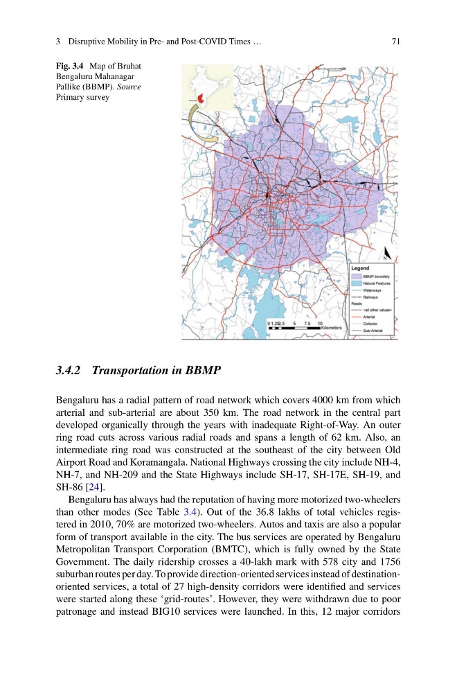
Fig. 3.4 Map of Bruhat
Bengaluru Mahanagar
Pallike (BBMP). Source
Primary survey
3.4.2 Transportation in BBMP
Bengaluru has a radial pattern of road network which covers 4000 km from which
arterial and sub-arterial are about 350 km. The road network in the central part
developed organically through the years with inadequate Right-of-Way. An outer
ring road cuts across various radial roads and spans a length of 62 km. Also, an
intermediate ring road was constructed at the southeast of the city between Old
Airport Road and Koramangala. National Highways crossing the city include NH-4,
NH-7, and NH-209 and the State Highways include SH-17, SH-17E, SH-19, and
SH-86 [24].
Bengaluru has always had the reputation of having more motorized two-wheelers
than other modes (See Table 3.4). Out of the 36.8 lakhs of total vehicles registered in 2010, 70% are motorized two-wheelers. Autos and taxis are also a popular
form of transport available in the city. The bus services are operated by Bengaluru
Metropolitan Transport Corporation (BMTC), which is fully owned by the State
Government. The daily ridership crosses a 40-lakh mark with 578 city and 1756
suburban routes per day. To provide direction-oriented services instead of destinationoriented services, a total of 27 high-density corridors were identified and services
were started along these ‘grid-routes’. However, they were withdrawn due to poor
patronage and instead BIG10 services were launched. In this, 12 major corridors
71
Fig. 3.4 Map of Bruhat
Bengaluru Mahanagar
Pallike (BBMP). Source
Primary survey
3.4.2 Transportation in BBMP
Bengaluru has a radial pattern of road network which covers 4000 km from which
arterial and sub-arterial are about 350 km. The road network in the central part
developed organically through the years with inadequate Right-of-Way. An outer
ring road cuts across various radial roads and spans a length of 62 km. Also, an
intermediate ring road was constructed at the southeast of the city between Old
Airport Road and Koramangala. National Highways crossing the city include NH-4,
NH-7, and NH-209 and the State Highways include SH-17, SH-17E, SH-19, and
SH-86 [24].
Bengaluru has always had the reputation of having more motorized two-wheelers
than other modes (See Table 3.4). Out of the 36.8 lakhs of total vehicles registered in 2010, 70% are motorized two-wheelers. Autos and taxis are also a popular
form of transport available in the city. The bus services are operated by Bengaluru
Metropolitan Transport Corporation (BMTC), which is fully owned by the State
Government. The daily ridership crosses a 40-lakh mark with 578 city and 1756
suburban routes per day. To provide direction-oriented services instead of destinationoriented services, a total of 27 high-density corridors were identified and services
were started along these ‘grid-routes’. However, they were withdrawn due to poor
patronage and instead BIG10 services were launched. In this, 12 major corridors