

reveal any stable layer of groundwater and can’t draw water during dry seasons.
The monitored water may not be isolated enough for quality monitoring, for the too
small distance (about 1 m) between the existing background monitoring well and
the landfill area, which does not conform to the layout requirements of groundwater
monitoring wells or the verification requirements stipulated in the Guide. Hence,
one background monitoring well is required to be drilled according to the layout
requirement in the Guide. The background well will not meet the 30–50 m distance
requirements required by the draft of the Guide in respects of layout distance, but
will be laid out about 15 m from the landfill area at the north upstream of the
landfill area as shown in Fig. 5.108, due to the roads on the periphery at the north
upstream of the landfill area and the pits and hills across the roads which do not
allow the performance of construction. The data of the monitoring well of the
hazardous waste disposal site are detailed in Table 5.123.
The site of well construction is shown in Fig. 5.109. After pit sinking and
borehole completion, the sediments in the well shall be cleared away and the wall
shall be flushed. The well shall be backfilled to 15 m below surface with filler
(gravels) after the trip-in of pipe, and 273 steel pipe shall be cased outside the 160
PE pipe at the upper part of the well from 0 to 9 m. The part from 0 to 15 m shall be
backfilled with clay. The wellhead protective barrel should be made of steel, with
an I.D. of 160 mm and a height of 50 cm, with the lower part embedded in the
cement platform by 10 cm for fixing. The cement platform is a 15 cm thick square
cement platform with a side length of 80 cm and the four corners well rounded
(Fig. 5.110). After the well has been constructed, the self-priming pump shall be
used to flush the well. The water will be sucked up in each monitoring well, and be
tested to have a turbidity below 5 NTU. The well flushing will be completed if the
water sucked up meets the above requirement.
Hydrogeological section
Elevation (m)
(elevation system of
HuanghaiSea)
Scale
Legend:
Fill
soil
Lime
stone
Dolom
ite
Marble
Groundw
ater level
Symbol
Elevation
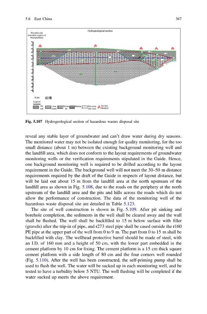
Fig. 5.107 Hydrogeological section of hazardous wastes disposal site
5.6 East China
367
The monitored water may not be isolated enough for quality monitoring, for the too
small distance (about 1 m) between the existing background monitoring well and
the landfill area, which does not conform to the layout requirements of groundwater
monitoring wells or the verification requirements stipulated in the Guide. Hence,
one background monitoring well is required to be drilled according to the layout
requirement in the Guide. The background well will not meet the 30–50 m distance
requirements required by the draft of the Guide in respects of layout distance, but
will be laid out about 15 m from the landfill area at the north upstream of the
landfill area as shown in Fig. 5.108, due to the roads on the periphery at the north
upstream of the landfill area and the pits and hills across the roads which do not
allow the performance of construction. The data of the monitoring well of the
hazardous waste disposal site are detailed in Table 5.123.
The site of well construction is shown in Fig. 5.109. After pit sinking and
borehole completion, the sediments in the well shall be cleared away and the wall
shall be flushed. The well shall be backfilled to 15 m below surface with filler
(gravels) after the trip-in of pipe, and 273 steel pipe shall be cased outside the 160
PE pipe at the upper part of the well from 0 to 9 m. The part from 0 to 15 m shall be
backfilled with clay. The wellhead protective barrel should be made of steel, with
an I.D. of 160 mm and a height of 50 cm, with the lower part embedded in the
cement platform by 10 cm for fixing. The cement platform is a 15 cm thick square
cement platform with a side length of 80 cm and the four corners well rounded
(Fig. 5.110). After the well has been constructed, the self-priming pump shall be
used to flush the well. The water will be sucked up in each monitoring well, and be
tested to have a turbidity below 5 NTU. The well flushing will be completed if the
water sucked up meets the above requirement.
Hydrogeological section
Elevation (m)
(elevation system of
HuanghaiSea)
Scale
Legend:
Fill
soil
Lime
stone
Dolom
ite
Marble
Groundw
ater level
Symbol
Elevation
Fig. 5.107 Hydrogeological section of hazardous wastes disposal site
5.6 East China
367