

88
Jahai and Jakun sub-tribes. The settlement was located between three strategic locations, namely Kuala Berang town, which was the administrative centre of Hulu
Terengganu district, the Sultan Mahmud hydroelectric dam and Sungai Chomo, an
Aquaculture Industrial Zone (AIZ). A road was constructed to connect these important locations, thus indirectly benefiting Kampung Sungai Berua and allowing the
villagers to interact with the outside world. Besides road accessibility, the village
was also provided with electricity and clean water supply.
Data Collection
Data was collected from August 2015 to February 2016. Primary and secondary
data were collected during the study period. The collection of primary data involved
field surveys; in-depth interviews and observation by participating in the activities
of the Orang Asli. Permission to interview villagers was obtained from the Orang
Asli Development Department (JAKOA) and the village headman. A total of 96
respondents, including hunter-gatherers, family heads, traditional medicine practitioners and elders, were interviewed. Information on aquatic resources were
acquired with the aid of pictures to facilitate confirmation. In-situ observation on
the daily activities of Orang Asli involved recording and taking pictures of them
acquiring the resources. Identification of aquatic resources was performed using
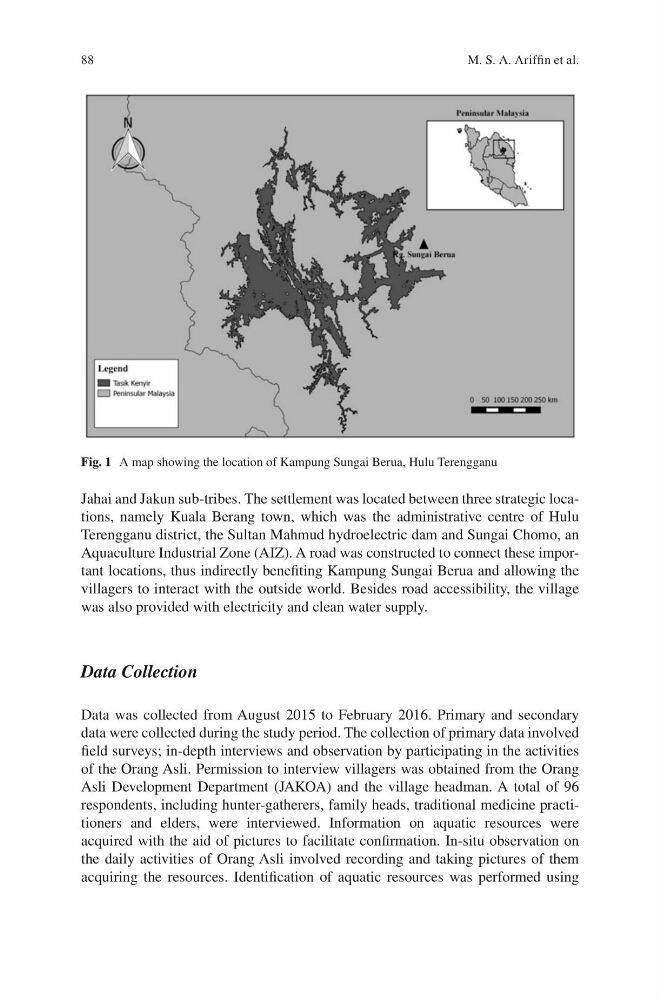
Fig. 1 A map showing the location of Kampung Sungai Berua, Hulu Terengganu
M. S. A. Ariffin et al.
Jahai and Jakun sub-tribes. The settlement was located between three strategic locations, namely Kuala Berang town, which was the administrative centre of Hulu
Terengganu district, the Sultan Mahmud hydroelectric dam and Sungai Chomo, an
Aquaculture Industrial Zone (AIZ). A road was constructed to connect these important locations, thus indirectly benefiting Kampung Sungai Berua and allowing the
villagers to interact with the outside world. Besides road accessibility, the village
was also provided with electricity and clean water supply.
Data Collection
Data was collected from August 2015 to February 2016. Primary and secondary
data were collected during the study period. The collection of primary data involved
field surveys; in-depth interviews and observation by participating in the activities
of the Orang Asli. Permission to interview villagers was obtained from the Orang
Asli Development Department (JAKOA) and the village headman. A total of 96
respondents, including hunter-gatherers, family heads, traditional medicine practitioners and elders, were interviewed. Information on aquatic resources were
acquired with the aid of pictures to facilitate confirmation. In-situ observation on
the daily activities of Orang Asli involved recording and taking pictures of them
acquiring the resources. Identification of aquatic resources was performed using
Fig. 1 A map showing the location of Kampung Sungai Berua, Hulu Terengganu
M. S. A. Ariffin et al.