

12
Flooding and Landform Stability
Pahang river systems are very mature, snaking slowly with oxbows through the
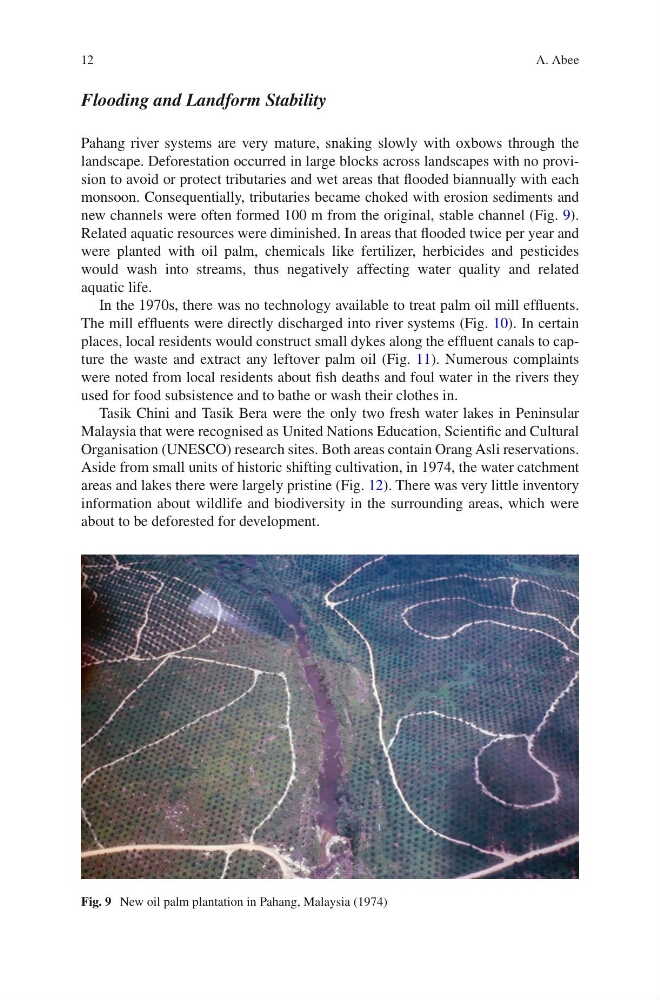
landscape. Deforestation occurred in large blocks across landscapes with no provision to avoid or protect tributaries and wet areas that flooded biannually with each
monsoon. Consequentially, tributaries became choked with erosion sediments and
new channels were often formed 100 m from the original, stable channel (Fig. 9).
Related aquatic resources were diminished. In areas that flooded twice per year and
were planted with oil palm, chemicals like fertilizer, herbicides and pesticides
would wash into streams, thus negatively affecting water quality and related
aquatic life.
In the 1970s, there was no technology available to treat palm oil mill effluents.
The mill effluents were directly discharged into river systems (Fig. 10). In certain
places, local residents would construct small dykes along the effluent canals to capture the waste and extract any leftover palm oil (Fig. 11). Numerous complaints
were noted from local residents about fish deaths and foul water in the rivers they
used for food subsistence and to bathe or wash their clothes in.
Tasik Chini and Tasik Bera were the only two fresh water lakes in Peninsular
Malaysia that were recognised as United Nations Education, Scientific and Cultural
Organisation (UNESCO) research sites. Both areas contain Orang Asli reservations.
Aside from small units of historic shifting cultivation, in 1974, the water catchment
areas and lakes there were largely pristine (Fig. 12). There was very little inventory
information about wildlife and biodiversity in the surrounding areas, which were
about to be deforested for development.
Fig. 9 New oil palm plantation in Pahang, Malaysia (1974)
A. Abee
Flooding and Landform Stability
Pahang river systems are very mature, snaking slowly with oxbows through the
landscape. Deforestation occurred in large blocks across landscapes with no provision to avoid or protect tributaries and wet areas that flooded biannually with each
monsoon. Consequentially, tributaries became choked with erosion sediments and
new channels were often formed 100 m from the original, stable channel (Fig. 9).
Related aquatic resources were diminished. In areas that flooded twice per year and
were planted with oil palm, chemicals like fertilizer, herbicides and pesticides
would wash into streams, thus negatively affecting water quality and related
aquatic life.
In the 1970s, there was no technology available to treat palm oil mill effluents.
The mill effluents were directly discharged into river systems (Fig. 10). In certain
places, local residents would construct small dykes along the effluent canals to capture the waste and extract any leftover palm oil (Fig. 11). Numerous complaints
were noted from local residents about fish deaths and foul water in the rivers they
used for food subsistence and to bathe or wash their clothes in.
Tasik Chini and Tasik Bera were the only two fresh water lakes in Peninsular
Malaysia that were recognised as United Nations Education, Scientific and Cultural
Organisation (UNESCO) research sites. Both areas contain Orang Asli reservations.
Aside from small units of historic shifting cultivation, in 1974, the water catchment
areas and lakes there were largely pristine (Fig. 12). There was very little inventory
information about wildlife and biodiversity in the surrounding areas, which were
about to be deforested for development.
Fig. 9 New oil palm plantation in Pahang, Malaysia (1974)
A. Abee