

Rufina Beach and Sustainable Development: The Role of Women …
369
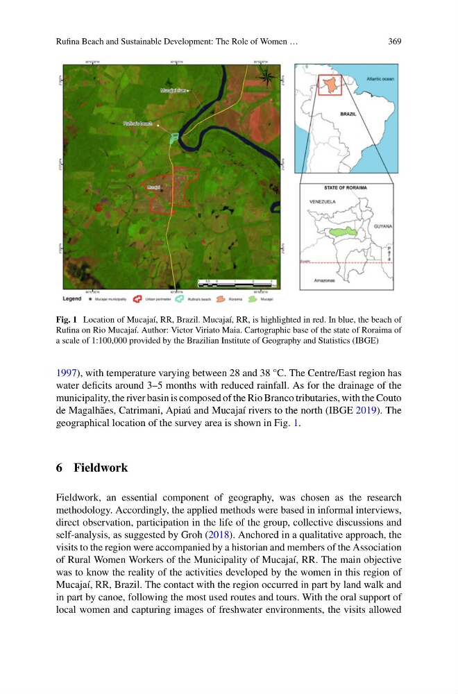
Fig. 1 Location of Mucajaí, RR, Brazil. Mucajaí, RR, is highlighted in red. In blue, the beach of
Rufina on Rio Mucajaí. Author: Victor Viriato Maia. Cartographic base of the state of Roraima of
a scale of 1:100,000 provided by the Brazilian Institute of Geography and Statistics (IBGE)
1997), with temperature varying between 28 and 38 °C. The Centre/East region has
water deficits around 3–5 months with reduced rainfall. As for the drainage of the
municipality, the river basin is composed of the Rio Branco tributaries, with the Couto
de Magalhães, Catrimani, Apiaú and Mucajaí rivers to the north (IBGE 2019). The
geographical location of the survey area is shown in Fig. 1.
6 Fieldwork
Fieldwork, an essential component of geography, was chosen as the research
methodology. Accordingly, the applied methods were based in informal interviews,
direct observation, participation in the life of the group, collective discussions and
self-analysis, as suggested by Groh (2018). Anchored in a qualitative approach, the
visits to the region were accompanied by a historian and members of the Association
of Rural Women Workers of the Municipality of Mucajaí, RR. The main objective
was to know the reality of the activities developed by the women in this region of
Mucajaí, RR, Brazil. The contact with the region occurred in part by land walk and
in part by canoe, following the most used routes and tours. With the oral support of
local women and capturing images of freshwater environments, the visits allowed
369
Fig. 1 Location of Mucajaí, RR, Brazil. Mucajaí, RR, is highlighted in red. In blue, the beach of
Rufina on Rio Mucajaí. Author: Victor Viriato Maia. Cartographic base of the state of Roraima of
a scale of 1:100,000 provided by the Brazilian Institute of Geography and Statistics (IBGE)
1997), with temperature varying between 28 and 38 °C. The Centre/East region has
water deficits around 3–5 months with reduced rainfall. As for the drainage of the
municipality, the river basin is composed of the Rio Branco tributaries, with the Couto
de Magalhães, Catrimani, Apiaú and Mucajaí rivers to the north (IBGE 2019). The
geographical location of the survey area is shown in Fig. 1.
6 Fieldwork
Fieldwork, an essential component of geography, was chosen as the research
methodology. Accordingly, the applied methods were based in informal interviews,
direct observation, participation in the life of the group, collective discussions and
self-analysis, as suggested by Groh (2018). Anchored in a qualitative approach, the
visits to the region were accompanied by a historian and members of the Association
of Rural Women Workers of the Municipality of Mucajaí, RR. The main objective
was to know the reality of the activities developed by the women in this region of
Mucajaí, RR, Brazil. The contact with the region occurred in part by land walk and
in part by canoe, following the most used routes and tours. With the oral support of
local women and capturing images of freshwater environments, the visits allowed