

264
R. G. Malucelli et al.
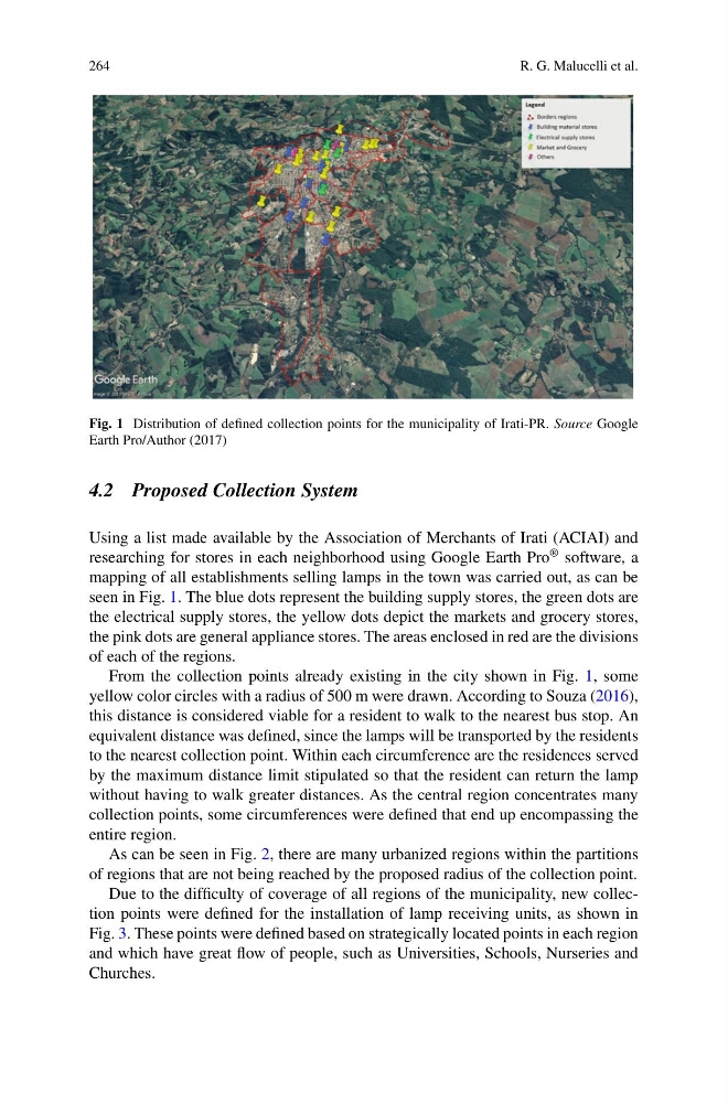
Fig. 1 Distribution of defined collection points for the municipality of Irati-PR. Source Google
Earth Pro/Author (2017)
4.2 Proposed Collection System
Using a list made available by the Association of Merchants of Irati (ACIAI) and
researching for stores in each neighborhood using Google Earth Pro
® software, a
mapping of all establishments selling lamps in the town was carried out, as can be
seen in Fig. 1. The blue dots represent the building supply stores, the green dots are
the electrical supply stores, the yellow dots depict the markets and grocery stores,
the pink dots are general appliance stores. The areas enclosed in red are the divisions
of each of the regions.
From the collection points already existing in the city shown in Fig. 1, some
yellow color circles with a radius of 500 m were drawn. According to Souza (2016),
this distance is considered viable for a resident to walk to the nearest bus stop. An
equivalent distance was defined, since the lamps will be transported by the residents
to the nearest collection point. Within each circumference are the residences served
by the maximum distance limit stipulated so that the resident can return the lamp
without having to walk greater distances. As the central region concentrates many
collection points, some circumferences were defined that end up encompassing the
entire region.
As can be seen in Fig. 2, there are many urbanized regions within the partitions
of regions that are not being reached by the proposed radius of the collection point.
Due to the difficulty of coverage of all regions of the municipality, new collection points were defined for the installation of lamp receiving units, as shown in
Fig. 3. These points were defined based on strategically located points in each region
and which have great flow of people, such as Universities, Schools, Nurseries and
Churches.
R. G. Malucelli et al.
Fig. 1 Distribution of defined collection points for the municipality of Irati-PR. Source Google
Earth Pro/Author (2017)
4.2 Proposed Collection System
Using a list made available by the Association of Merchants of Irati (ACIAI) and
researching for stores in each neighborhood using Google Earth Pro
® software, a
mapping of all establishments selling lamps in the town was carried out, as can be
seen in Fig. 1. The blue dots represent the building supply stores, the green dots are
the electrical supply stores, the yellow dots depict the markets and grocery stores,
the pink dots are general appliance stores. The areas enclosed in red are the divisions
of each of the regions.
From the collection points already existing in the city shown in Fig. 1, some
yellow color circles with a radius of 500 m were drawn. According to Souza (2016),
this distance is considered viable for a resident to walk to the nearest bus stop. An
equivalent distance was defined, since the lamps will be transported by the residents
to the nearest collection point. Within each circumference are the residences served
by the maximum distance limit stipulated so that the resident can return the lamp
without having to walk greater distances. As the central region concentrates many
collection points, some circumferences were defined that end up encompassing the
entire region.
As can be seen in Fig. 2, there are many urbanized regions within the partitions
of regions that are not being reached by the proposed radius of the collection point.
Due to the difficulty of coverage of all regions of the municipality, new collection points were defined for the installation of lamp receiving units, as shown in
Fig. 3. These points were defined based on strategically located points in each region
and which have great flow of people, such as Universities, Schools, Nurseries and
Churches.