

12 Sediment Management in River Basins: An Essential Element …
267
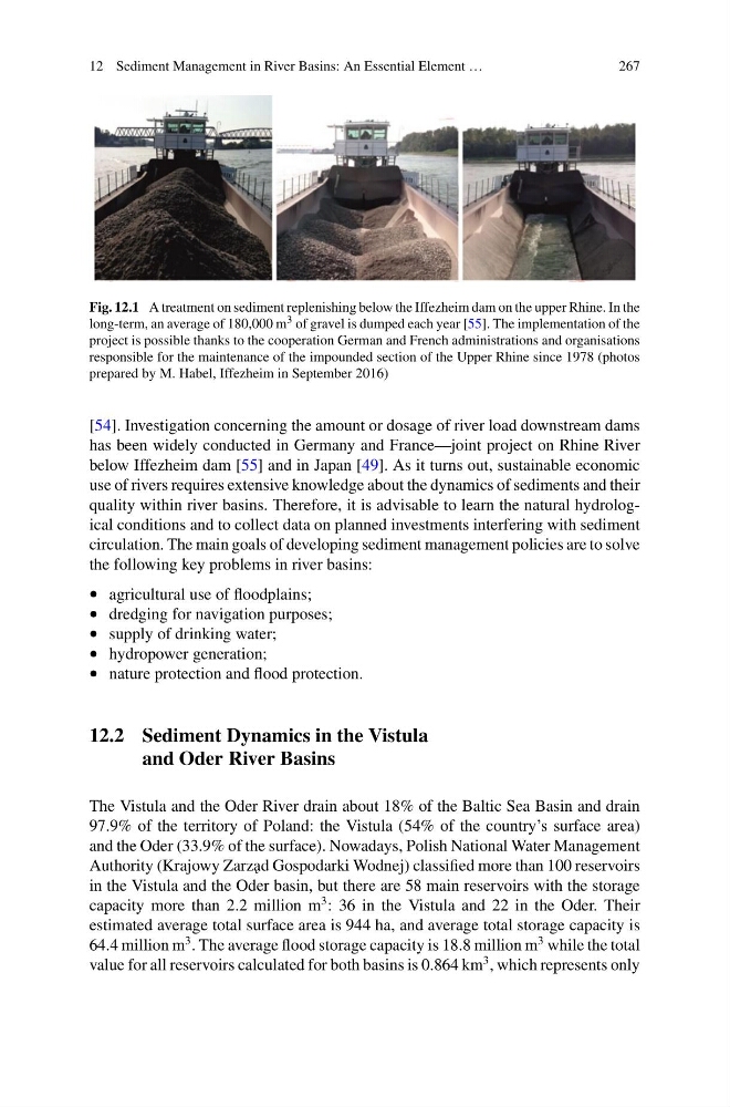
Fig. 12.1 A treatment on sediment replenishing below the Iffezheim dam on the upper Rhine. In the
long-term, an average of 180,000 m 3 of gravel is dumped each year [55]. The implementation of the
project is possible thanks to the cooperation German and French administrations and organisations
responsible for the maintenance of the impounded section of the Upper Rhine since 1978 (photos
prepared by M. Habel, Iffezheim in September 2016)
[54]. Investigation concerning the amount or dosage of river load downstream dams
has been widely conducted in Germany and France—joint project on Rhine River
below Iffezheim dam [55] and in Japan [49]. As it turns out, sustainable economic
use of rivers requires extensive knowledge about the dynamics of sediments and their
quality within river basins. Therefore, it is advisable to learn the natural hydrological conditions and to collect data on planned investments interfering with sediment
circulation. The main goals of developing sediment management policies are to solve
the following key problems in river basins:
• agricultural use of floodplains;
• dredging for navigation purposes;
• supply of drinking water;
• hydropower generation;
• nature protection and flood protection.
12.2 Sediment Dynamics in the Vistula
and Oder River Basins
The Vistula and the Oder River drain about 18% of the Baltic Sea Basin and drain
97.9% of the territory of Poland: the Vistula (54% of the country’s surface area)
and the Oder (33.9% of the surface). Nowadays, Polish National Water Management
Authority (Krajowy Zarz˛ ad Gospodarki Wodnej) classified more than 100 reservoirs
in the Vistula and the Oder basin, but there are 58 main reservoirs with the storage
capacity more than 2.2 million m
3 : 36 in the Vistula and 22 in the Oder. Their
estimated average total surface area is 944 ha, and average total storage capacity is
64.4 million m
3 . The average flood storage capacity is 18.8 million m
3 while the total
value for all reservoirs calculated for both basins is 0.864 km
3 , which represents only
267
Fig. 12.1 A treatment on sediment replenishing below the Iffezheim dam on the upper Rhine. In the
long-term, an average of 180,000 m 3 of gravel is dumped each year [55]. The implementation of the
project is possible thanks to the cooperation German and French administrations and organisations
responsible for the maintenance of the impounded section of the Upper Rhine since 1978 (photos
prepared by M. Habel, Iffezheim in September 2016)
[54]. Investigation concerning the amount or dosage of river load downstream dams
has been widely conducted in Germany and France—joint project on Rhine River
below Iffezheim dam [55] and in Japan [49]. As it turns out, sustainable economic
use of rivers requires extensive knowledge about the dynamics of sediments and their
quality within river basins. Therefore, it is advisable to learn the natural hydrological conditions and to collect data on planned investments interfering with sediment
circulation. The main goals of developing sediment management policies are to solve
the following key problems in river basins:
• agricultural use of floodplains;
• dredging for navigation purposes;
• supply of drinking water;
• hydropower generation;
• nature protection and flood protection.
12.2 Sediment Dynamics in the Vistula
and Oder River Basins
The Vistula and the Oder River drain about 18% of the Baltic Sea Basin and drain
97.9% of the territory of Poland: the Vistula (54% of the country’s surface area)
and the Oder (33.9% of the surface). Nowadays, Polish National Water Management
Authority (Krajowy Zarz˛ ad Gospodarki Wodnej) classified more than 100 reservoirs
in the Vistula and the Oder basin, but there are 58 main reservoirs with the storage
capacity more than 2.2 million m
3 : 36 in the Vistula and 22 in the Oder. Their
estimated average total surface area is 944 ha, and average total storage capacity is
64.4 million m
3 . The average flood storage capacity is 18.8 million m
3 while the total
value for all reservoirs calculated for both basins is 0.864 km
3 , which represents only