

MATERIELS AND METHODS
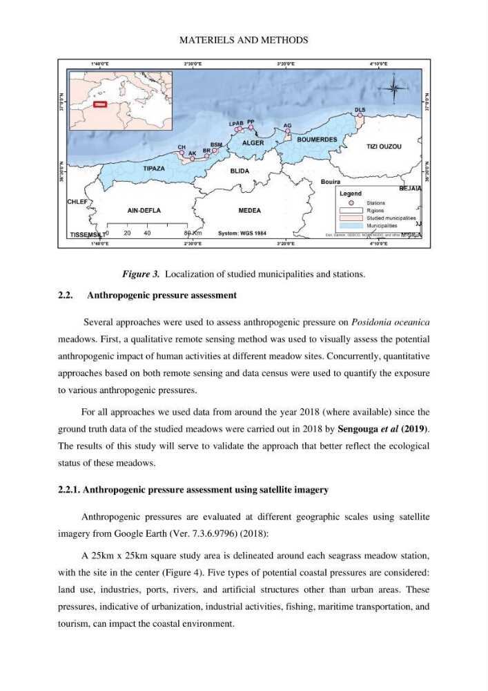
Figure 3. Localization of studied municipalities and stations.
2.2. Anthropogenic pressure assessment
Several approaches were used to assess anthropogenic pressure on Posidonia oceanica
meadows. First, a qualitative remote sensing method was used to visually assess the potential
anthropogenic impact of human activities at different meadow sites. Concurrently, quantitative
approaches based on both remote sensing and data census were used to quantify the exposure
to various anthropogenic pressures.
For all approaches we used data from around the year 2018 (where available) since the
ground truth data of the studied meadows were carried out in 2018 by Sengouga et al (2019).
The results of this study will serve to validate the approach that better reflect the ecological
status of these meadows.
2.2.1. Anthropogenic pressure assessment using satellite imagery
Anthropogenic pressures are evaluated at different geographic scales using satellite
imagery from Google Earth (Ver. 7.3.6.9796) (2018):
A 25km x 25km square study area is delineated around each seagrass meadow station,
with the site in the center (Figure 4). Five types of potential coastal pressures are considered:
land use, industries, ports, rivers, and artificial structures other than urban areas. These
pressures, indicative of urbanization, industrial activities, fishing, maritime transportation, and
tourism, can impact the coastal environment.
Figure 3. Localization of studied municipalities and stations.
2.2. Anthropogenic pressure assessment
Several approaches were used to assess anthropogenic pressure on Posidonia oceanica
meadows. First, a qualitative remote sensing method was used to visually assess the potential
anthropogenic impact of human activities at different meadow sites. Concurrently, quantitative
approaches based on both remote sensing and data census were used to quantify the exposure
to various anthropogenic pressures.
For all approaches we used data from around the year 2018 (where available) since the
ground truth data of the studied meadows were carried out in 2018 by Sengouga et al (2019).
The results of this study will serve to validate the approach that better reflect the ecological
status of these meadows.
2.2.1. Anthropogenic pressure assessment using satellite imagery
Anthropogenic pressures are evaluated at different geographic scales using satellite
imagery from Google Earth (Ver. 7.3.6.9796) (2018):
A 25km x 25km square study area is delineated around each seagrass meadow station,
with the site in the center (Figure 4). Five types of potential coastal pressures are considered:
land use, industries, ports, rivers, and artificial structures other than urban areas. These
pressures, indicative of urbanization, industrial activities, fishing, maritime transportation, and
tourism, can impact the coastal environment.