

Additional Material
235
(continued)
No. State Intellectual
Property Office,
China
European Patent Office (https://www.epo.org/index.html)
Inventor(s). Title
(Grant No.)
Bibliographic
data
Webpage and abstract
9
Xu X Z, Xu F L,
Zhao C, Xu Y, Guo X
Y. A measurement
method to model the
3D landform
(ZL201010144689.7)
CN101865690
(A)—2010-10-20
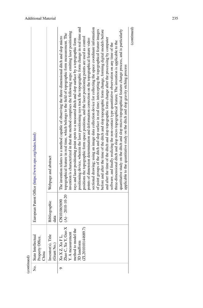
The invention relates to a method capable of observing the three-dimensional ditch and slop micro
topographical feature in real time, which belongs to the field of topographic form measurement. The
invention is characterized in that the method comprises the following steps: emitting laser positioning
rays and laser positioning point spots to a measured ditch and slop surface by a topographic form
positioning device, wherein the laser positioning rays track the topographic form change in real time and
positions the topographic form space positions, and the laser positioning points are used as control
points of dimension determination and deformation correction on the topographical feature video
sectional drawing; using an image data collection device for collecting the space coordinate information
of point groups of the ditch and slop surface in real time; intercepting the topographical feature images
before and after the time of the ditch and slop topographic form change, forming digital models before
and after the time of the ditch and slop topographic form change after the processing by computer
software, and finally realizing the non-contact type quantitative observation on any time of the
three-dimensional ditch and slop micro topographical feature. The invention is applicable to the
quantitative study on the ditch and slop micro topographical feature change process, and is particularly
applicable to the quantitative study on the ditch and slop gravity etching process
(continued)
235
(continued)
No. State Intellectual
Property Office,
China
European Patent Office (https://www.epo.org/index.html)
Inventor(s). Title
(Grant No.)
Bibliographic
data
Webpage and abstract
9
Xu X Z, Xu F L,
Zhao C, Xu Y, Guo X
Y. A measurement
method to model the
3D landform
(ZL201010144689.7)
CN101865690
(A)—2010-10-20
The invention relates to a method capable of observing the three-dimensional ditch and slop micro
topographical feature in real time, which belongs to the field of topographic form measurement. The
invention is characterized in that the method comprises the following steps: emitting laser positioning
rays and laser positioning point spots to a measured ditch and slop surface by a topographic form
positioning device, wherein the laser positioning rays track the topographic form change in real time and
positions the topographic form space positions, and the laser positioning points are used as control
points of dimension determination and deformation correction on the topographical feature video
sectional drawing; using an image data collection device for collecting the space coordinate information
of point groups of the ditch and slop surface in real time; intercepting the topographical feature images
before and after the time of the ditch and slop topographic form change, forming digital models before
and after the time of the ditch and slop topographic form change after the processing by computer
software, and finally realizing the non-contact type quantitative observation on any time of the
three-dimensional ditch and slop micro topographical feature. The invention is applicable to the
quantitative study on the ditch and slop micro topographical feature change process, and is particularly
applicable to the quantitative study on the ditch and slop gravity etching process
(continued)