

Water Chemistry Field Sampling
70
also be made in the field with commercially available analysis kits, but the data
obtained using these methods typically only provide a rough approximation
that may not be sufficiently accurate or precise for inventory or monitoring.
Meters with probes that continuously monitor pH and specific conductance
are also available. These probes effectively characterize temporal variability
but lack the precision and accuracy of laboratory measurements. The need for
temporal resolution should be weighed against DQOs, logistics, and costs to
determine if in situ monitoring is advantageous.
2.3.3.3.2 Physical Data
Interpretation of water chemistry data can be significantly aided by ancillary
physical measurements such as air and water temperature, weather conditions,
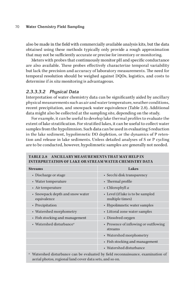
recent precipitation, and snowpack water equivalence (Table 2.8). Additional
data might also be collected at the sampling site, depending on the study.
For example, it can be useful to develop lake thermal profiles to evaluate the
extent of lake stratification. For stratified lakes, it can be useful to collect water
samples from the hypolimnion. Such data can be used in evaluating S reduction
in the lake sediment, hypolimnetic DO depletion, or the dynamics of P retention and release in lake sediments. Unless detailed analyses of S or P cycling
are to be conducted, however, hypolimnetic samples are generally not needed.
TABLE 2.8 ANCILLARY MEASUREMENTS THAT MAY HELP IN
INTERPRETATION OF LAKE OR STREAM WATER CHEMISTRY DATA
Streams
Lakes
• Discharge or stage
• Secchi disk transparency
• Water temperature
• Thermal profile
• Air temperature
• Chlorophyll a
• Snowpack depth and snow water
equivalence
• Level (if lake is to be sampled
multiple times)
• Precipitation
• Hypolimnetic water samples
• Watershed morphometry
• Littoral zone water samples
• Fish stocking and management
• Dissolved oxygen
• Watershed disturbance a
• Presence of inflowing or outflowing
streams
• Watershed morphometry
• Fish stocking and management
• Watershed disturbance
a Watershed disturbance can be evaluated by field reconnaissance, examination of
aerial photos, regional land cover data sets, and so on.
70
also be made in the field with commercially available analysis kits, but the data
obtained using these methods typically only provide a rough approximation
that may not be sufficiently accurate or precise for inventory or monitoring.
Meters with probes that continuously monitor pH and specific conductance
are also available. These probes effectively characterize temporal variability
but lack the precision and accuracy of laboratory measurements. The need for
temporal resolution should be weighed against DQOs, logistics, and costs to
determine if in situ monitoring is advantageous.
2.3.3.3.2 Physical Data
Interpretation of water chemistry data can be significantly aided by ancillary
physical measurements such as air and water temperature, weather conditions,
recent precipitation, and snowpack water equivalence (Table 2.8). Additional
data might also be collected at the sampling site, depending on the study.
For example, it can be useful to develop lake thermal profiles to evaluate the
extent of lake stratification. For stratified lakes, it can be useful to collect water
samples from the hypolimnion. Such data can be used in evaluating S reduction
in the lake sediment, hypolimnetic DO depletion, or the dynamics of P retention and release in lake sediments. Unless detailed analyses of S or P cycling
are to be conducted, however, hypolimnetic samples are generally not needed.
TABLE 2.8 ANCILLARY MEASUREMENTS THAT MAY HELP IN
INTERPRETATION OF LAKE OR STREAM WATER CHEMISTRY DATA
Streams
Lakes
• Discharge or stage
• Secchi disk transparency
• Water temperature
• Thermal profile
• Air temperature
• Chlorophyll a
• Snowpack depth and snow water
equivalence
• Level (if lake is to be sampled
multiple times)
• Precipitation
• Hypolimnetic water samples
• Watershed morphometry
• Littoral zone water samples
• Fish stocking and management
• Dissolved oxygen
• Watershed disturbance a
• Presence of inflowing or outflowing
streams
• Watershed morphometry
• Fish stocking and management
• Watershed disturbance
a Watershed disturbance can be evaluated by field reconnaissance, examination of
aerial photos, regional land cover data sets, and so on.