

36 An Air Quality Modeling System Providing Smoke Impact …
235
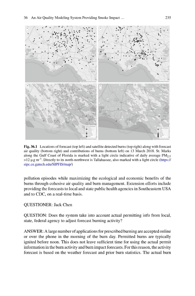
Fig. 36.1 Locations of forecast (top left) and satellite detected burns (top right) along with forecast
air quality (bottom right) and contributions of burns (bottom left) on 13 March 2018. St. Marks
along the Gulf Coast of Florida is marked with a light circle indicative of daily average PM 2.5
>12 µg m -3 . Directly to its north-northwest is Tallahassee, also marked with a light circle (https://
sipc.ce.gatech.edu/SIPFIS/map/)
pollution episodes while maximizing the ecological and economic benefits of the
burns through cohesive air quality and burn management. Extension efforts include
providing the forecasts to local and state public health agencies in Southeastern USA
and to CDC, on a real-time basis.
QUESTIONER: Jack Chen
QUESTION: Does the system take into account actual permitting info from local,
state, federal agency to adjust forecast burning activity?
ANSWER: A large number of applications for prescribed burning are accepted online
or over the phone in the morning of the burn day. Permitted burns are typically
ignited before noon. This does not leave sufficient time for using the actual permit
information in the burn activity and burn impact forecasts. For this reason, the activity
forecast is based on the weather forecast and prior burn statistics. The actual burn
235
Fig. 36.1 Locations of forecast (top left) and satellite detected burns (top right) along with forecast
air quality (bottom right) and contributions of burns (bottom left) on 13 March 2018. St. Marks
along the Gulf Coast of Florida is marked with a light circle indicative of daily average PM 2.5
>12 µg m -3 . Directly to its north-northwest is Tallahassee, also marked with a light circle (https://
sipc.ce.gatech.edu/SIPFIS/map/)
pollution episodes while maximizing the ecological and economic benefits of the
burns through cohesive air quality and burn management. Extension efforts include
providing the forecasts to local and state public health agencies in Southeastern USA
and to CDC, on a real-time basis.
QUESTIONER: Jack Chen
QUESTION: Does the system take into account actual permitting info from local,
state, federal agency to adjust forecast burning activity?
ANSWER: A large number of applications for prescribed burning are accepted online
or over the phone in the morning of the burn day. Permitted burns are typically
ignited before noon. This does not leave sufficient time for using the actual permit
information in the burn activity and burn impact forecasts. For this reason, the activity
forecast is based on the weather forecast and prior burn statistics. The actual burn