

Climate Change Impacts and Implications: An Indian Perspective
19
9 Role of Geoinformation Science in Climate Change
Research
Geoinformation science has provided a new dimension to global climate change
research over the past few decades and has significantly been contributing in climate change monitoring through continuously observing remote sensing satellites
by providing biological, physical, and chemical parameters on a global scale at varied resolutions (Justice et al. 2002; Gou et al. 2015). A climate change monitoring
system is an amalgamation of satellite observations, ground-based data and forecast
models to monitor and forecast changes in the weather and climate with reference to
historical patterns shift due to frequent and repetitive coverage of earth’s environment
(Tucker and Sellers 1986). It is widely used to estimate various parameters in the
domain of atmosphere, oceanic and terrestrial which has provided major advances in
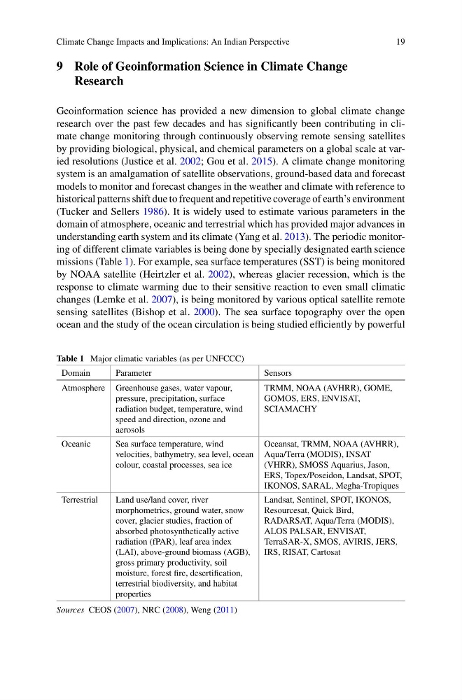
understanding earth system and its climate (Yang et al. 2013). The periodic monitoring of different climate variables is being done by specially designated earth science
missions (Table 1). For example, sea surface temperatures (SST) is being monitored
by NOAA satellite (Heirtzler et al. 2002), whereas glacier recession, which is the
response to climate warming due to their sensitive reaction to even small climatic
changes (Lemke et al. 2007), is being monitored by various optical satellite remote
sensing satellites (Bishop et al. 2000). The sea surface topography over the open
ocean and the study of the ocean circulation is being studied efficiently by powerful
Table 1 Major climatic variables (as per UNFCCC)
Domain
Parameter
Sensors
Atmosphere Greenhouse gases, water vapour,
pressure, precipitation, surface
radiation budget, temperature, wind
speed and direction, ozone and
aerosols
TRMM, NOAA (AVHRR), GOME,
GOMOS, ERS, ENVISAT,
SCIAMACHY
Oceanic
Sea surface temperature, wind
velocities, bathymetry, sea level, ocean
colour, coastal processes, sea ice
Oceansat, TRMM, NOAA (AVHRR),
Aqua/Terra (MODIS), INSAT
(VHRR), SMOSS Aquarius, Jason,
ERS, Topex/Poseidon, Landsat, SPOT,
IKONOS, SARAL, Megha-Tropiques
Terrestrial
Land use/land cover, river
morphometrics, ground water, snow
cover, glacier studies, fraction of
absorbed photosynthetically active
radiation (fPAR), leaf area index
(LAI), above-ground biomass (AGB),
gross primary productivity, soil
moisture, forest fire, desertification,
terrestrial biodiversity, and habitat
properties
Landsat, Sentinel, SPOT, IKONOS,
Resourcesat, Quick Bird,
RADARSAT, Aqua/Terra (MODIS),
ALOS PALSAR, ENVISAT,
TerraSAR-X, SMOS, AVIRIS, JERS,
IRS, RISAT, Cartosat
Sources CEOS (2007), NRC (2008), Weng (2011)
19
9 Role of Geoinformation Science in Climate Change
Research
Geoinformation science has provided a new dimension to global climate change
research over the past few decades and has significantly been contributing in climate change monitoring through continuously observing remote sensing satellites
by providing biological, physical, and chemical parameters on a global scale at varied resolutions (Justice et al. 2002; Gou et al. 2015). A climate change monitoring
system is an amalgamation of satellite observations, ground-based data and forecast
models to monitor and forecast changes in the weather and climate with reference to
historical patterns shift due to frequent and repetitive coverage of earth’s environment
(Tucker and Sellers 1986). It is widely used to estimate various parameters in the
domain of atmosphere, oceanic and terrestrial which has provided major advances in
understanding earth system and its climate (Yang et al. 2013). The periodic monitoring of different climate variables is being done by specially designated earth science
missions (Table 1). For example, sea surface temperatures (SST) is being monitored
by NOAA satellite (Heirtzler et al. 2002), whereas glacier recession, which is the
response to climate warming due to their sensitive reaction to even small climatic
changes (Lemke et al. 2007), is being monitored by various optical satellite remote
sensing satellites (Bishop et al. 2000). The sea surface topography over the open
ocean and the study of the ocean circulation is being studied efficiently by powerful
Table 1 Major climatic variables (as per UNFCCC)
Domain
Parameter
Sensors
Atmosphere Greenhouse gases, water vapour,
pressure, precipitation, surface
radiation budget, temperature, wind
speed and direction, ozone and
aerosols
TRMM, NOAA (AVHRR), GOME,
GOMOS, ERS, ENVISAT,
SCIAMACHY
Oceanic
Sea surface temperature, wind
velocities, bathymetry, sea level, ocean
colour, coastal processes, sea ice
Oceansat, TRMM, NOAA (AVHRR),
Aqua/Terra (MODIS), INSAT
(VHRR), SMOSS Aquarius, Jason,
ERS, Topex/Poseidon, Landsat, SPOT,
IKONOS, SARAL, Megha-Tropiques
Terrestrial
Land use/land cover, river
morphometrics, ground water, snow
cover, glacier studies, fraction of
absorbed photosynthetically active
radiation (fPAR), leaf area index
(LAI), above-ground biomass (AGB),
gross primary productivity, soil
moisture, forest fire, desertification,
terrestrial biodiversity, and habitat
properties
Landsat, Sentinel, SPOT, IKONOS,
Resourcesat, Quick Bird,
RADARSAT, Aqua/Terra (MODIS),
ALOS PALSAR, ENVISAT,
TerraSAR-X, SMOS, AVIRIS, JERS,
IRS, RISAT, Cartosat
Sources CEOS (2007), NRC (2008), Weng (2011)