

330
L. Zaharia et al.
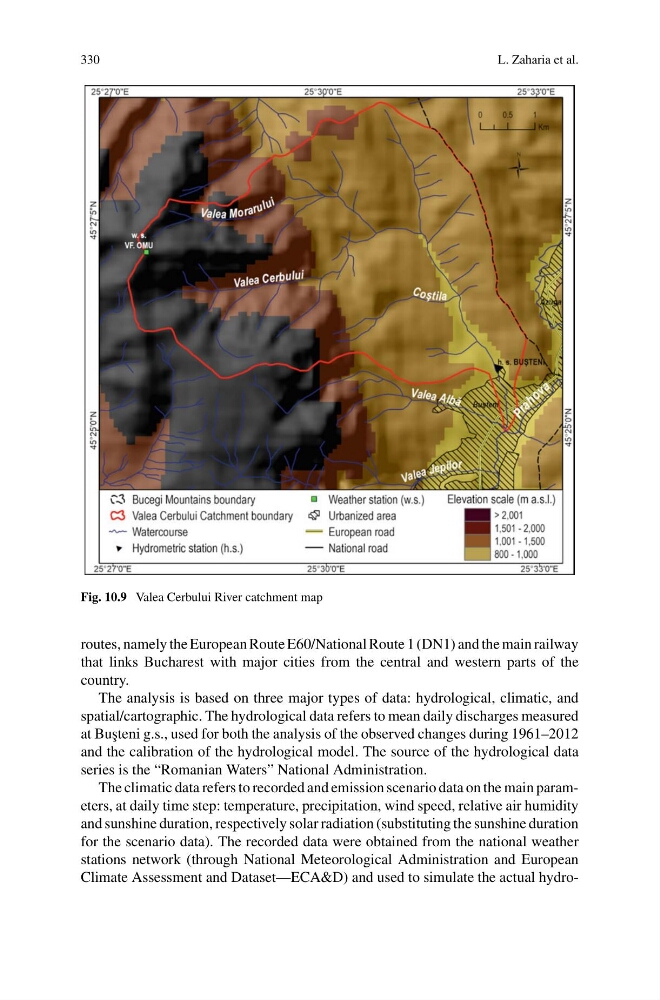
Fig. 10.9 Valea Cerbului River catchment map
routes, namely the European Route E60/National Route 1 (DN1) and the main railway
that links Bucharest with major cities from the central and western parts of the
country.
The analysis is based on three major types of data: hydrological, climatic, and
spatial/cartographic. The hydrological data refers to mean daily discharges measured
at Bu¸ steni g.s., used for both the analysis of the observed changes during 1961–2012
and the calibration of the hydrological model. The source of the hydrological data
series is the “Romanian Waters” National Administration.
The climatic data refers to recorded and emission scenario data on the main parameters, at daily time step: temperature, precipitation, wind speed, relative air humidity
and sunshine duration, respectively solar radiation (substituting the sunshine duration
for the scenario data). The recorded data were obtained from the national weather
stations network (through National Meteorological Administration and European
Climate Assessment and Dataset—ECA&D) and used to simulate the actual hydro-
L. Zaharia et al.
Fig. 10.9 Valea Cerbului River catchment map
routes, namely the European Route E60/National Route 1 (DN1) and the main railway
that links Bucharest with major cities from the central and western parts of the
country.
The analysis is based on three major types of data: hydrological, climatic, and
spatial/cartographic. The hydrological data refers to mean daily discharges measured
at Bu¸ steni g.s., used for both the analysis of the observed changes during 1961–2012
and the calibration of the hydrological model. The source of the hydrological data
series is the “Romanian Waters” National Administration.
The climatic data refers to recorded and emission scenario data on the main parameters, at daily time step: temperature, precipitation, wind speed, relative air humidity
and sunshine duration, respectively solar radiation (substituting the sunshine duration
for the scenario data). The recorded data were obtained from the national weather
stations network (through National Meteorological Administration and European
Climate Assessment and Dataset—ECA&D) and used to simulate the actual hydro-