

9 Deforestation and Frequency of Floods in Romania
289
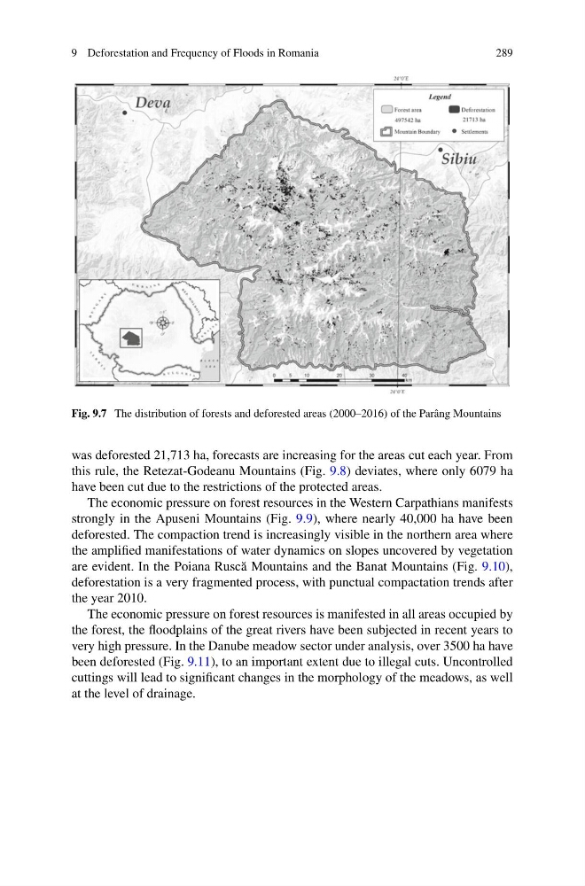
Fig. 9.7 The distribution of forests and deforested areas (2000–2016) of the Parâng Mountains
was deforested 21,713 ha, forecasts are increasing for the areas cut each year. From
this rule, the Retezat-Godeanu Mountains (Fig. 9.8) deviates, where only 6079 ha
have been cut due to the restrictions of the protected areas.
The economic pressure on forest resources in the Western Carpathians manifests
strongly in the Apuseni Mountains (Fig. 9.9), where nearly 40,000 ha have been
deforested. The compaction trend is increasingly visible in the northern area where
the amplified manifestations of water dynamics on slopes uncovered by vegetation
are evident. In the Poiana Rusc˘ a Mountains and the Banat Mountains (Fig. 9.10),
deforestation is a very fragmented process, with punctual compactation trends after
the year 2010.
The economic pressure on forest resources is manifested in all areas occupied by
the forest, the floodplains of the great rivers have been subjected in recent years to
very high pressure. In the Danube meadow sector under analysis, over 3500 ha have
been deforested (Fig. 9.11), to an important extent due to illegal cuts. Uncontrolled
cuttings will lead to significant changes in the morphology of the meadows, as well
at the level of drainage.
289
Fig. 9.7 The distribution of forests and deforested areas (2000–2016) of the Parâng Mountains
was deforested 21,713 ha, forecasts are increasing for the areas cut each year. From
this rule, the Retezat-Godeanu Mountains (Fig. 9.8) deviates, where only 6079 ha
have been cut due to the restrictions of the protected areas.
The economic pressure on forest resources in the Western Carpathians manifests
strongly in the Apuseni Mountains (Fig. 9.9), where nearly 40,000 ha have been
deforested. The compaction trend is increasingly visible in the northern area where
the amplified manifestations of water dynamics on slopes uncovered by vegetation
are evident. In the Poiana Rusc˘ a Mountains and the Banat Mountains (Fig. 9.10),
deforestation is a very fragmented process, with punctual compactation trends after
the year 2010.
The economic pressure on forest resources is manifested in all areas occupied by
the forest, the floodplains of the great rivers have been subjected in recent years to
very high pressure. In the Danube meadow sector under analysis, over 3500 ha have
been deforested (Fig. 9.11), to an important extent due to illegal cuts. Uncontrolled
cuttings will lead to significant changes in the morphology of the meadows, as well
at the level of drainage.