

123
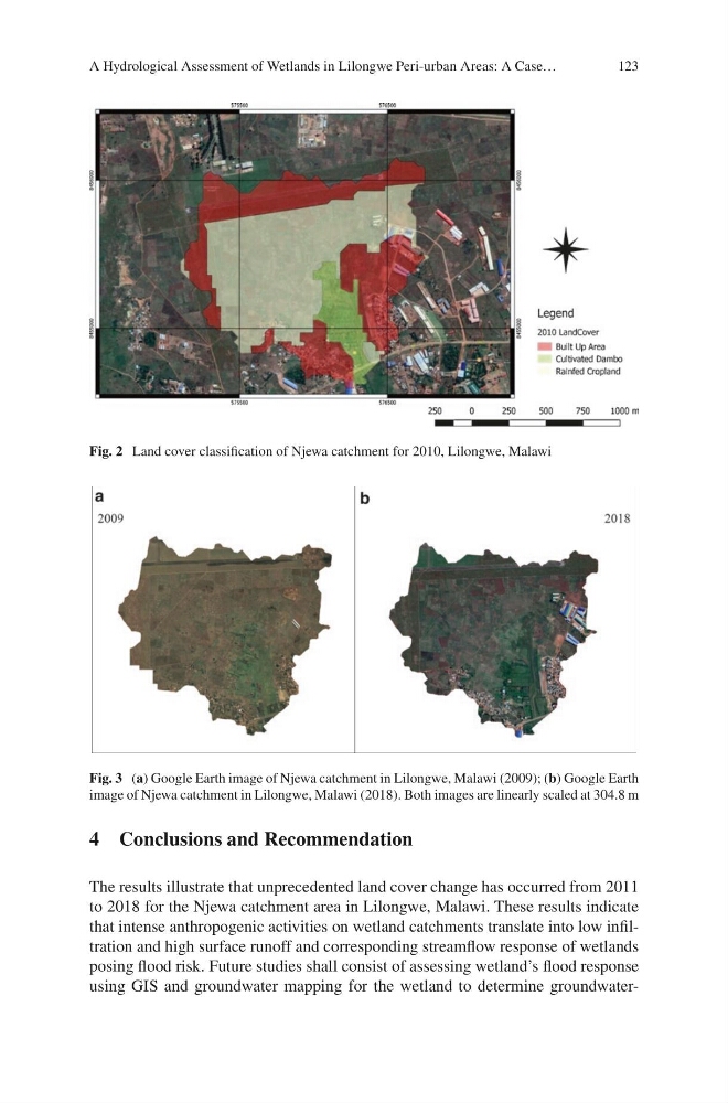
Fig. 2 Land cover classification of Njewa catchment for 2010, Lilongwe, Malawi
Fig. 3 (a) Google Earth image of Njewa catchment in Lilongwe, Malawi (2009); (b) Google Earth
image of Njewa catchment in Lilongwe, Malawi (2018). Both images are linearly scaled at 304.8 m
4 Conclusions and Recommendation
The results illustrate that unprecedented land cover change has occurred from 2011
to 2018 for the Njewa catchment area in Lilongwe, Malawi. These results indicate
that intense anthropogenic activities on wetland catchments translate into low infiltration and high surface runoff and corresponding streamflow response of wetlands
posing flood risk. Future studies shall consist of assessing wetland’s flood response
using GIS and groundwater mapping for the wetland to determine groundwaterA Hydrological Assessment of Wetlands in Lilongwe Peri-urban Areas: A Case…
Fig. 2 Land cover classification of Njewa catchment for 2010, Lilongwe, Malawi
Fig. 3 (a) Google Earth image of Njewa catchment in Lilongwe, Malawi (2009); (b) Google Earth
image of Njewa catchment in Lilongwe, Malawi (2018). Both images are linearly scaled at 304.8 m
4 Conclusions and Recommendation
The results illustrate that unprecedented land cover change has occurred from 2011
to 2018 for the Njewa catchment area in Lilongwe, Malawi. These results indicate
that intense anthropogenic activities on wetland catchments translate into low infiltration and high surface runoff and corresponding streamflow response of wetlands
posing flood risk. Future studies shall consist of assessing wetland’s flood response
using GIS and groundwater mapping for the wetland to determine groundwaterA Hydrological Assessment of Wetlands in Lilongwe Peri-urban Areas: A Case…