

Adventure Cards, Process Wheels, and a Vision …
427
tr at to n C en te r W 2 0
N o r t h
C o u r t
S ta ta
C en te r
W 3 2
C e n t r a l U t il it ie s P la n t W
4 2
V a s s a r S t r e e t
G re en
B ui ld in g 5 4
M c D e r m o t t
C o u r t
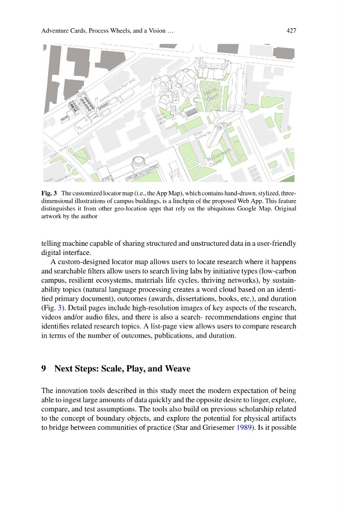
Fig. 3 The customized locator map (i.e., the App Map), which contains hand-drawn, stylized, threedimensional illustrations of campus buildings, is a linchpin of the proposed Web App. This feature
distinguishes it from other geo-location apps that rely on the ubiquitous Google Map. Original
artwork by the author
telling machine capable of sharing structured and unstructured data in a user-friendly
digital interface.
A custom-designed locator map allows users to locate research where it happens
and searchable filters allow users to search living labs by initiative types (low-carbon
campus, resilient ecosystems, materials life cycles, thriving networks), by sustainability topics (natural language processing creates a word cloud based on an identified primary document), outcomes (awards, dissertations, books, etc.), and duration
(Fig. 3). Detail pages include high-resolution images of key aspects of the research,
videos and/or audio files, and there is also a search- recommendations engine that
identifies related research topics. A list-page view allows users to compare research
in terms of the number of outcomes, publications, and duration.
9 Next Steps: Scale, Play, and Weave
The innovation tools described in this study meet the modern expectation of being
able to ingest large amounts of data quickly and the opposite desire to linger, explore,
compare, and test assumptions. The tools also build on previous scholarship related
to the concept of boundary objects, and explore the potential for physical artifacts
to bridge between communities of practice (Star and Griesemer 1989). Is it possible
427
tr at to n C en te r W 2 0
N o r t h
C o u r t
S ta ta
C en te r
W 3 2
C e n t r a l U t il it ie s P la n t W
4 2
V a s s a r S t r e e t
G re en
B ui ld in g 5 4
M c D e r m o t t
C o u r t
Fig. 3 The customized locator map (i.e., the App Map), which contains hand-drawn, stylized, threedimensional illustrations of campus buildings, is a linchpin of the proposed Web App. This feature
distinguishes it from other geo-location apps that rely on the ubiquitous Google Map. Original
artwork by the author
telling machine capable of sharing structured and unstructured data in a user-friendly
digital interface.
A custom-designed locator map allows users to locate research where it happens
and searchable filters allow users to search living labs by initiative types (low-carbon
campus, resilient ecosystems, materials life cycles, thriving networks), by sustainability topics (natural language processing creates a word cloud based on an identified primary document), outcomes (awards, dissertations, books, etc.), and duration
(Fig. 3). Detail pages include high-resolution images of key aspects of the research,
videos and/or audio files, and there is also a search- recommendations engine that
identifies related research topics. A list-page view allows users to compare research
in terms of the number of outcomes, publications, and duration.
9 Next Steps: Scale, Play, and Weave
The innovation tools described in this study meet the modern expectation of being
able to ingest large amounts of data quickly and the opposite desire to linger, explore,
compare, and test assumptions. The tools also build on previous scholarship related
to the concept of boundary objects, and explore the potential for physical artifacts
to bridge between communities of practice (Star and Griesemer 1989). Is it possible