

445
Once these datasets are collected, they are stored in (spatial) databases, which
allow location-based queries about soil properties, plant properties, farm management practices, and yield. For example, queries such as “where is the location in the
field with high moisture and low fertilizer?” can be easily answered using spatial
databases.
Data mining tools are widely used for precision agriculture tasks. For example,
hotspot analysis in spatial data mining is used to determine the hotspots of locations
where the soil has high nutrient or moisture levels to prevent applying more fertilizer or irrigation to these locations.
Similarly, co-location pattern mining tasks are used to determine which combination of fertilizer and water makes the crops healthier and in which location of the
field. In addition, spatial data mining tasks allow predicting future yield from a field.
These yield projections help farmers make a crop type decision for the next harvesting season. They also give more insights about the causes of low or high yields, best
crop type for a specific type of soil and location in a field, etc.
Similarly, path planning and navigation systems promote efficient traversing of
farms without unnecessary soil compaction, (spatial) statistical analysis tools help
delineate management zones in large farms, and spatial decision support systems
help optimize yield while preserving energy and water use by site-specific irrigation
selection.
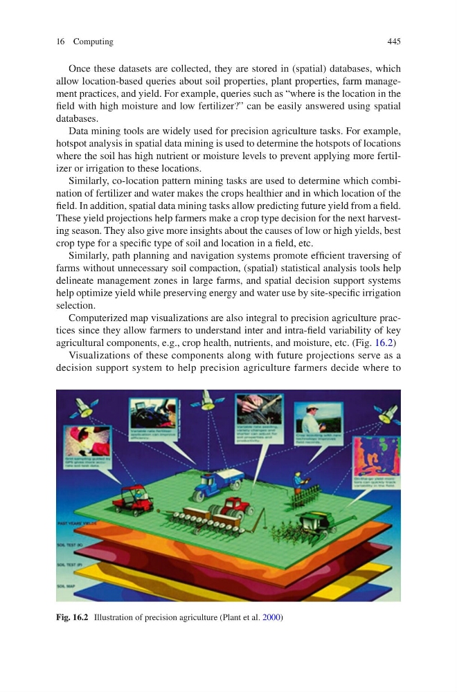
Computerized map visualizations are also integral to precision agriculture practices since they allow farmers to understand inter and intra-field variability of key
agricultural components, e.g., crop health, nutrients, and moisture, etc. (Fig. 16.2)
Visualizations of these components along with future projections serve as a
decision support system to help precision agriculture farmers decide where to
Fig. 16.2 Illustration of precision agriculture (Plant et al. 2000)
16 Computing
Once these datasets are collected, they are stored in (spatial) databases, which
allow location-based queries about soil properties, plant properties, farm management practices, and yield. For example, queries such as “where is the location in the
field with high moisture and low fertilizer?” can be easily answered using spatial
databases.
Data mining tools are widely used for precision agriculture tasks. For example,
hotspot analysis in spatial data mining is used to determine the hotspots of locations
where the soil has high nutrient or moisture levels to prevent applying more fertilizer or irrigation to these locations.
Similarly, co-location pattern mining tasks are used to determine which combination of fertilizer and water makes the crops healthier and in which location of the
field. In addition, spatial data mining tasks allow predicting future yield from a field.
These yield projections help farmers make a crop type decision for the next harvesting season. They also give more insights about the causes of low or high yields, best
crop type for a specific type of soil and location in a field, etc.
Similarly, path planning and navigation systems promote efficient traversing of
farms without unnecessary soil compaction, (spatial) statistical analysis tools help
delineate management zones in large farms, and spatial decision support systems
help optimize yield while preserving energy and water use by site-specific irrigation
selection.
Computerized map visualizations are also integral to precision agriculture practices since they allow farmers to understand inter and intra-field variability of key
agricultural components, e.g., crop health, nutrients, and moisture, etc. (Fig. 16.2)
Visualizations of these components along with future projections serve as a
decision support system to help precision agriculture farmers decide where to
Fig. 16.2 Illustration of precision agriculture (Plant et al. 2000)
16 Computing