

484
D. S. Barcellos et al.
sites, enhances engagement in the defense of its watersheds, and increases the quantity and availability of information on water pollution and water quality, an essential
issue for the management of water resources. Voluntary monitoring has low costs, as
gathering data and information involves collaboration among stakeholders, including academia, private industry, citizens, and local, state and federal governments
(USEPA 2016).
4 Characteristics of the Belém River Basin
The water catchment area of the Belém river is part of the Iguaçu Basin, located in the
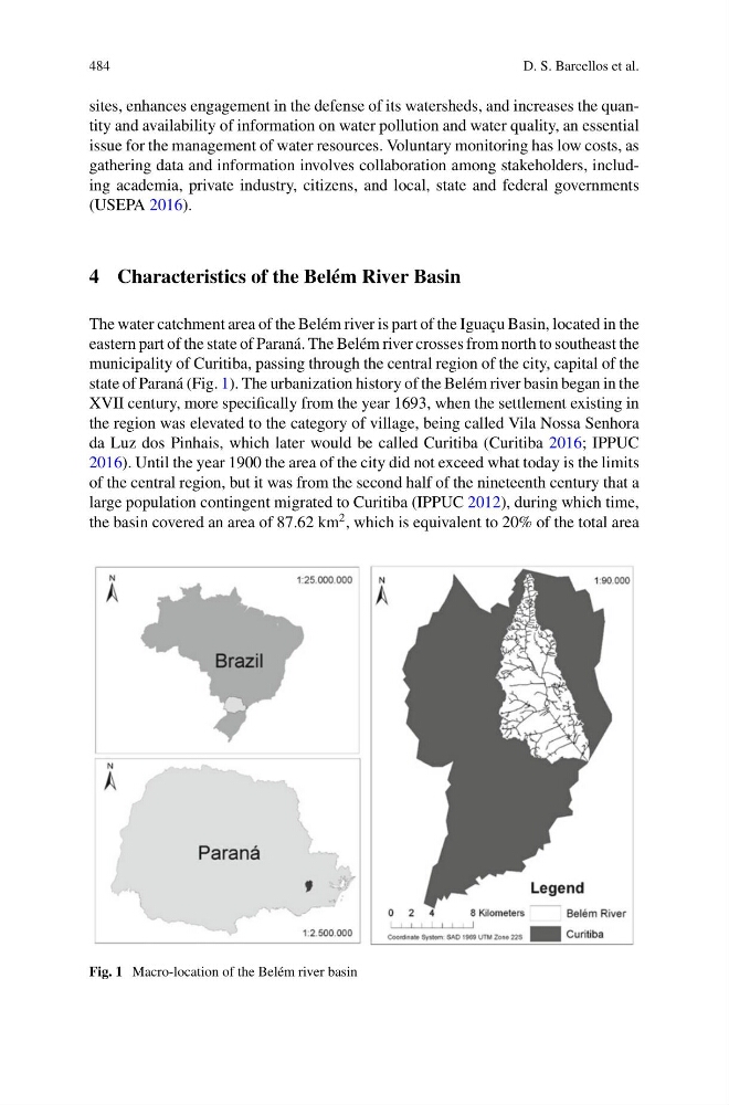
eastern part of the state of Paraná. The Belém river crosses from north to southeast the
municipality of Curitiba, passing through the central region of the city, capital of the
state of Paraná (Fig. 1). The urbanization history of the Belém river basin began in the
XVII century, more specifically from the year 1693, when the settlement existing in
the region was elevated to the category of village, being called Vila Nossa Senhora
da Luz dos Pinhais, which later would be called Curitiba (Curitiba 2016; IPPUC
2016). Until the year 1900 the area of the city did not exceed what today is the limits
of the central region, but it was from the second half of the nineteenth century that a
large population contingent migrated to Curitiba (IPPUC 2012), during which time,
the basin covered an area of 87.62 km
2 , which is equivalent to 20% of the total area
Fig. 1 Macro-location of the Belém river basin
D. S. Barcellos et al.
sites, enhances engagement in the defense of its watersheds, and increases the quantity and availability of information on water pollution and water quality, an essential
issue for the management of water resources. Voluntary monitoring has low costs, as
gathering data and information involves collaboration among stakeholders, including academia, private industry, citizens, and local, state and federal governments
(USEPA 2016).
4 Characteristics of the Belém River Basin
The water catchment area of the Belém river is part of the Iguaçu Basin, located in the
eastern part of the state of Paraná. The Belém river crosses from north to southeast the
municipality of Curitiba, passing through the central region of the city, capital of the
state of Paraná (Fig. 1). The urbanization history of the Belém river basin began in the
XVII century, more specifically from the year 1693, when the settlement existing in
the region was elevated to the category of village, being called Vila Nossa Senhora
da Luz dos Pinhais, which later would be called Curitiba (Curitiba 2016; IPPUC
2016). Until the year 1900 the area of the city did not exceed what today is the limits
of the central region, but it was from the second half of the nineteenth century that a
large population contingent migrated to Curitiba (IPPUC 2012), during which time,
the basin covered an area of 87.62 km
2 , which is equivalent to 20% of the total area
Fig. 1 Macro-location of the Belém river basin