

this would entail. We drove south on US Hwy 95 until it intersected with Nevada
state highway 359 and ran by Walker Lake. We stopped for dinner in the town of
Hawthorne, which is a major Army (formerly Navy) weapons depot. When viewed
from the comfort of an airliner flying at 30,000 feet above, the area outside of
Hawthorne consists of innumerable oddly shaped geometric patterns, which are
weapon storage bunkers. After dinner, we continued east on Hwy 359 which
wound through the hills of the Toiyabe National Forest. It was pitch dark and we
were the only vehicles on the road for the entire 2 h trip, a weirdly odd and somewhat
unnerving experience. Highway 359 descends into the eastern Mono Basin and
becomes California State Hwy 167 which traverses the northern rim of the basin.
Coming down from the eastern hills and entering the basin, we could discern from
afar, some 15 miles ahead in the distance, what appeared to be a faintly yellow
flashing. Since we were unfamiliar with our surroundings and the broad scale of
geographic distance entailed, and were still enveloped in total darkness, we eased
our way forward carefully until we eventually came to the yellow flashing light
source and saw that it was a traffic light at the intersection of the terminus of Hwy
167 and the north–south running Hwy 395. Thence we made a left turn and traveled
a few miles more along the western side of Mono Lake until the road began to rise a
few hundred feet, bringing us into the town of Lee Vining, CA. The rise in elevation
was the result of Lee Vining being situated atop a terminal moraine deposited by
considerate glaciers way back in the Pleistocene.
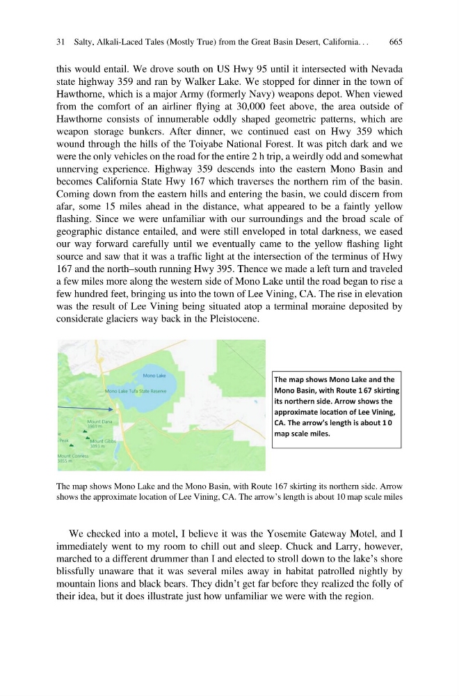
The map shows Mono Lake and the
Mono Basin, with Route 1 67 skirng
its northern side. Arrow shows the
approximate locaon of Lee Vining,
CA. The arrow’s length is about 1 0
map scale miles.
The map shows Mono Lake and the Mono Basin, with Route 167 skirting its northern side. Arrow
shows the approximate location of Lee Vining, CA. The arrow’s length is about 10 map scale miles
We checked into a motel, I believe it was the Yosemite Gateway Motel, and I
immediately went to my room to chill out and sleep. Chuck and Larry, however,
marched to a different drummer than I and elected to stroll down to the lake’s shore
blissfully unaware that it was several miles away in habitat patrolled nightly by
mountain lions and black bears. They didn’t get far before they realized the folly of
their idea, but it does illustrate just how unfamiliar we were with the region.
31 Salty, Alkali-Laced Tales (Mostly True) from the Great Basin Desert, California. . .
665