

the highway. Viewed from overhead, the jeep would display an evident sine wave
function as I drove it east across California’s Central Valley. By the time I reached
Manteca, I had learned to drape my chest and arms over the steering wheel as a
necessary expedient safety adaptation to dampen the amplitude of that sine wave so
as not to veer into oncoming traffic or drive off that narrow 2-lane highway. A
further test of the efficacy of that tactic came as I ascended the “Old Priest Grade” a
series of switchbacks that eventually brought me up into the foothills of the Sierra
Nevada’s gentle western slope and the town of Groveland. I continued on east along
highway 120 as it slowly rose toward the western entrance to Yosemite, after which I
stayed on 120, rather than descend into Yosemite’s fabled valley. The road gains
altitude and emerges out of the forested region and continues along the exposed
granite batholith with superlative views of the Valley below as well as Half Dome,
exposed mountain peaks and many stop-and-see vistas of exfoliating granite, rushing streams, and other resplendent natural wonders (e.g., Tenaya Lake; Tuolmne
Meadows). Compared to the very tame Catskill Mountains of my New York youth
and 5 years spent in graduate school in very, very flat Florida (Miami), this was quite
an eye-opening treat.
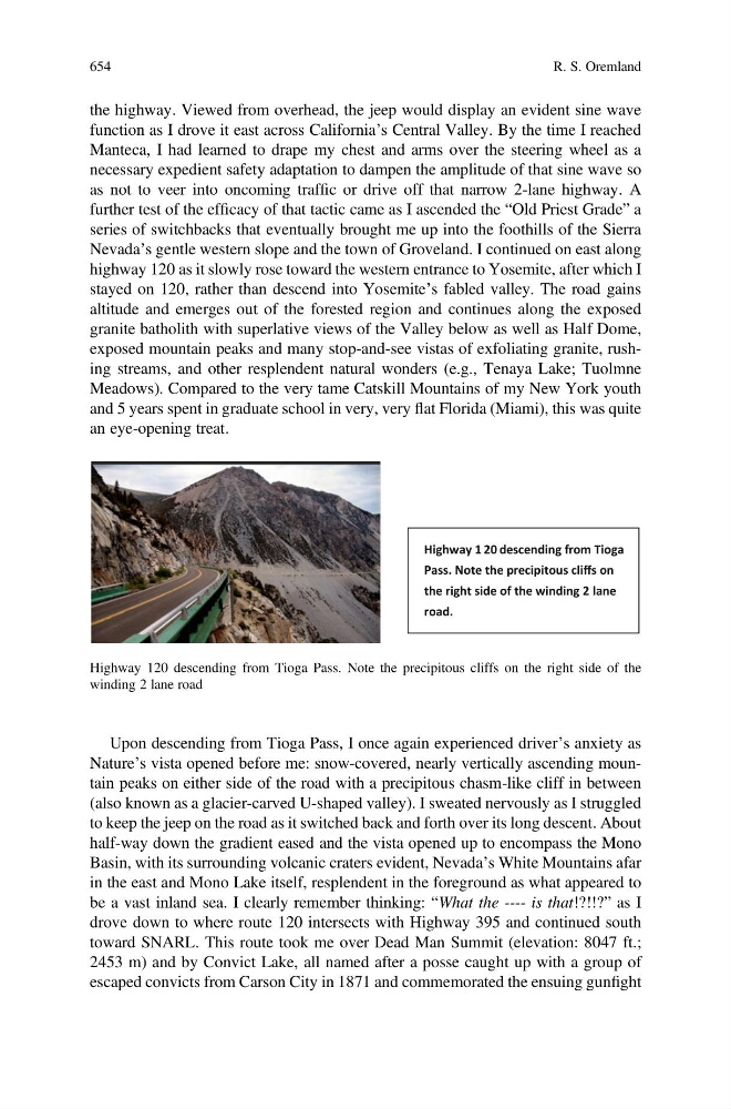
Highway 1 20 descending from Tioga
Pass. Note the precipitous cliffs on
the right side of the winding 2 lane
road.
Highway 120 descending from Tioga Pass. Note the precipitous cliffs on the right side of the
winding 2 lane road
Upon descending from Tioga Pass, I once again experienced driver’s anxiety as
Nature’s vista opened before me: snow-covered, nearly vertically ascending mountain peaks on either side of the road with a precipitous chasm-like cliff in between
(also known as a glacier-carved U-shaped valley). I sweated nervously as I struggled
to keep the jeep on the road as it switched back and forth over its long descent. About
half-way down the gradient eased and the vista opened up to encompass the Mono
Basin, with its surrounding volcanic craters evident, Nevada’s White Mountains afar
in the east and Mono Lake itself, resplendent in the foreground as what appeared to
be a vast inland sea. I clearly remember thinking: “What the ---- is that!?!!?” as I
drove down to where route 120 intersects with Highway 395 and continued south
toward SNARL. This route took me over Dead Man Summit (elevation: 8047 ft.;
2453 m) and by Convict Lake, all named after a posse caught up with a group of
escaped convicts from Carson City in 1871 and commemorated the ensuing gunfight
654
R. S. Oremland