

facilitates the utilization and automated delivery of agricultural data products. The
geospatial data and analytical services improve better utilization of geospatial
information in agriculture disaster monitoring and policymaking for many
concerned agencies.
References
ArcGIS. (2017). ArcGIS explorer desktop. http://www.esri.com/software/arcgis/explorer. Accessed
2 June 2017.
Boryan, C., Yang, Z., Mueller, R., & Craig, M. (2011). Monitoring US agriculture: The US
department of agriculture, national agricultural statistics service, cropland data layer program.
Geocarto International, 26, 341–358.
Botts, M., & Robin, A. (2007). OpenGIS Sensor Model Language (SensorML) implementation
specification.
Bröring, A., Stasch, C., & Echterhoff, J. (2012). OGC sensor observation service interface standard.
Open Geospatial Consort Interface Stand, 12–006.
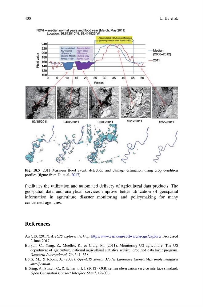
Fig. 18.5 2011 Missouri flood event: detection and damage estimation using crop condition
profiles (figure from Di et al. 2017)
400
L. Hu et al.
geospatial data and analytical services improve better utilization of geospatial
information in agriculture disaster monitoring and policymaking for many
concerned agencies.
References
ArcGIS. (2017). ArcGIS explorer desktop. http://www.esri.com/software/arcgis/explorer. Accessed
2 June 2017.
Boryan, C., Yang, Z., Mueller, R., & Craig, M. (2011). Monitoring US agriculture: The US
department of agriculture, national agricultural statistics service, cropland data layer program.
Geocarto International, 26, 341–358.
Botts, M., & Robin, A. (2007). OpenGIS Sensor Model Language (SensorML) implementation
specification.
Bröring, A., Stasch, C., & Echterhoff, J. (2012). OGC sensor observation service interface standard.
Open Geospatial Consort Interface Stand, 12–006.
Fig. 18.5 2011 Missouri flood event: detection and damage estimation using crop condition
profiles (figure from Di et al. 2017)
400
L. Hu et al.