

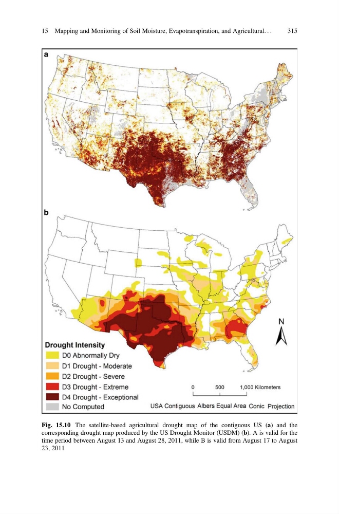
Fig. 15.10 The satellite-based agricultural drought map of the contiguous US (a) and the
corresponding drought map produced by the US Drought Monitor (USDM) (b). A is valid for the
time period between August 13 and August 28, 2011, while B is valid from August 17 to August
23, 2011
15 Mapping and Monitoring of Soil Moisture, Evapotranspiration, and Agricultural. . .
315
corresponding drought map produced by the US Drought Monitor (USDM) (b). A is valid for the
time period between August 13 and August 28, 2011, while B is valid from August 17 to August
23, 2011
15 Mapping and Monitoring of Soil Moisture, Evapotranspiration, and Agricultural. . .
315