

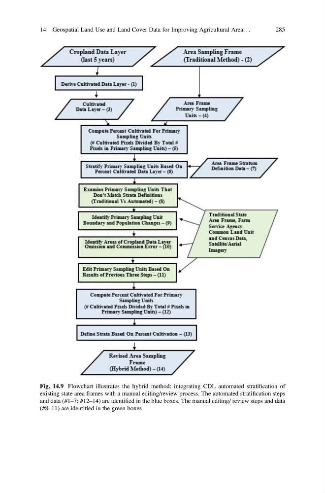
Fig. 14.9 Flowchart illustrates the hybrid method: integrating CDL automated stratification of
existing state area frames with a manual editing/review process. The automated stratification steps
and data (#1–7; #12–14) are identified in the blue boxes. The manual editing/ review steps and data
(#8–11) are identified in the green boxes
14 Geospatial Land Use and Land Cover Data for Improving Agricultural Area. . .
285
existing state area frames with a manual editing/review process. The automated stratification steps
and data (#1–7; #12–14) are identified in the blue boxes. The manual editing/ review steps and data
(#8–11) are identified in the green boxes
14 Geospatial Land Use and Land Cover Data for Improving Agricultural Area. . .
285