

2. Data preprocessing: Similar to those for cropland mapping, data preprocessing
for geometric correction, radiometric correction, and cloud masking is needed.
The monitoring of the crop status requires a time series of remotely sensed
observations to be used. Often the minimally required periods on time series
covers the growing season of a crop. In addition, the “normal” values to represent
the typical crop status at a location need to deal with data across years, which may
lead to the use of observations across generations of sensors or even different
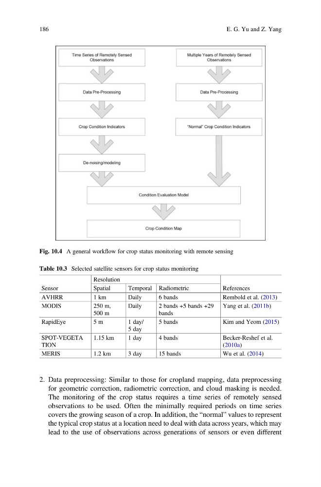
Fig. 10.4 A general workflow for crop status monitoring with remote sensing
Table 10.3 Selected satellite sensors for crop status monitoring
Sensor
Resolution
References
Spatial
Temporal Radiometric
AVHRR
1 km
Daily
6 bands
Rembold et al. (2013)
MODIS
250 m,
500 m
Daily
2 bands +5 bands +29
bands
Yang et al. (2011b)
RapidEye
5 m
1 day/
5 day
5 bands
Kim and Yeom (2015)
SPOT-VEGETA
TION
1.15 km
1 day
4 bands
Becker-Reshef et al.
(2010a)
MERIS
1.2 km
3 day
15 bands
Wu et al. (2014)
186
E. G. Yu and Z. Yang
for geometric correction, radiometric correction, and cloud masking is needed.
The monitoring of the crop status requires a time series of remotely sensed
observations to be used. Often the minimally required periods on time series
covers the growing season of a crop. In addition, the “normal” values to represent
the typical crop status at a location need to deal with data across years, which may
lead to the use of observations across generations of sensors or even different
Fig. 10.4 A general workflow for crop status monitoring with remote sensing
Table 10.3 Selected satellite sensors for crop status monitoring
Sensor
Resolution
References
Spatial
Temporal Radiometric
AVHRR
1 km
Daily
6 bands
Rembold et al. (2013)
MODIS
250 m,
500 m
Daily
2 bands +5 bands +29
bands
Yang et al. (2011b)
RapidEye
5 m
1 day/
5 day
5 bands
Kim and Yeom (2015)
SPOT-VEGETA
TION
1.15 km
1 day
4 bands
Becker-Reshef et al.
(2010a)
MERIS
1.2 km
3 day
15 bands
Wu et al. (2014)
186
E. G. Yu and Z. Yang