

120
Coastal Engineering: Theory and Practice
évolution to predict the shoreline patterns after constructing the groin field.
The shoreline patterns predict the shore advancement and érosion say after
1, 5, 10, 15, 20 and 25 years through numerical modelling.
The coastal activities in Tamil Nadu hâve been accelerating due to
industrial growth and tourism in addition to the primary habitants in the
région. On the other hand, the population density near the coast of Kérala
State is many times higher compared to its inner région. The majority of
the community residing along the coastal belt mainly dépends on fishing
related works. The coast has been experiencing perennial érosion and during 1950s to 1970s, nearly 400 km stretch of coastline had been protected
with seawalls of a standard cross-section, which was not location spécifie.
After the tsunami of 2004, the coast has been subjected to severe attack of
waves resulting in the instability of the coast, choking of river mouths and
land loss due to érosion. Master plans for coastal protection for maritime
States of Tamil Nadu and Kérala affected by tsunami 2004 was prepared
by mid-2005 by the authors. Although, several of them hâve been implemented only a few examples are presented and discussed in this chapter.
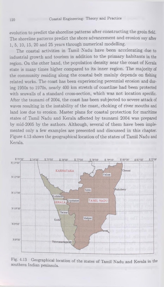
Figure 4.13 shows the geographical location of the States of Tamil Nadu and
Kérala.
l ig. 4.13 Geographical location of the States of Tamil Nadu and Kérala in the
Southern Indian peninsula.
Coastal Engineering: Theory and Practice
évolution to predict the shoreline patterns after constructing the groin field.
The shoreline patterns predict the shore advancement and érosion say after
1, 5, 10, 15, 20 and 25 years through numerical modelling.
The coastal activities in Tamil Nadu hâve been accelerating due to
industrial growth and tourism in addition to the primary habitants in the
région. On the other hand, the population density near the coast of Kérala
State is many times higher compared to its inner région. The majority of
the community residing along the coastal belt mainly dépends on fishing
related works. The coast has been experiencing perennial érosion and during 1950s to 1970s, nearly 400 km stretch of coastline had been protected
with seawalls of a standard cross-section, which was not location spécifie.
After the tsunami of 2004, the coast has been subjected to severe attack of
waves resulting in the instability of the coast, choking of river mouths and
land loss due to érosion. Master plans for coastal protection for maritime
States of Tamil Nadu and Kérala affected by tsunami 2004 was prepared
by mid-2005 by the authors. Although, several of them hâve been implemented only a few examples are presented and discussed in this chapter.
Figure 4.13 shows the geographical location of the States of Tamil Nadu and
Kérala.
l ig. 4.13 Geographical location of the States of Tamil Nadu and Kérala in the
Southern Indian peninsula.