

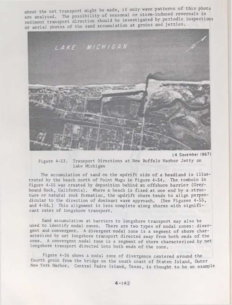
about the net transport might be made, if only wave patterns of this photo
are analyzed. The possibility of seasonal or storm-induced reversais in
sédiment transport direction should be investigated by penodic inspections
aerial photos of the sand accumulation at groins and jetties.
(4 December 1967)
Figure 4-53. Transport Directions at New Buffalo Harbor Jetty on
Lake Michigan
The accumulation of sand on the updrift side of a headland is illustrated by the beach north of Point Mugu in Figure 4-54. The tombolo in
Figure 4-55 was created by déposition behind an offshore barrier (Greyhound Rock, California). Where a beach is fixed at one end by a structure or natural rock formation, the updrift shore tends to align perpendicular to the direction of dominant wave approach.
(See Figures 4-55,
and 4-56.) This alignment is less complété along shores with significant rates of longshore transport.
Sand accumulation at barriers to longshore transport may also be
used to identify nodal zones. There are two types of nodal zones: divergent and convergent. A divergent nodal zone is a segment of shore characterized by net longshore transport directed away from both ends of the
zone. A convergent nodal zone is a segment of shore characterized by net
longshore transport directed into both ends of the zone.
Figure 4-56 shows a nodal zone of divergence centered around the
fourth groin from the bridge on the south coast of Staten Island, Outer
New York Harbor. Central Padre Island, Texas, is thought to be an example
4-142
are analyzed. The possibility of seasonal or storm-induced reversais in
sédiment transport direction should be investigated by penodic inspections
aerial photos of the sand accumulation at groins and jetties.
(4 December 1967)
Figure 4-53. Transport Directions at New Buffalo Harbor Jetty on
Lake Michigan
The accumulation of sand on the updrift side of a headland is illustrated by the beach north of Point Mugu in Figure 4-54. The tombolo in
Figure 4-55 was created by déposition behind an offshore barrier (Greyhound Rock, California). Where a beach is fixed at one end by a structure or natural rock formation, the updrift shore tends to align perpendicular to the direction of dominant wave approach.
(See Figures 4-55,
and 4-56.) This alignment is less complété along shores with significant rates of longshore transport.
Sand accumulation at barriers to longshore transport may also be
used to identify nodal zones. There are two types of nodal zones: divergent and convergent. A divergent nodal zone is a segment of shore characterized by net longshore transport directed away from both ends of the
zone. A convergent nodal zone is a segment of shore characterized by net
longshore transport directed into both ends of the zone.
Figure 4-56 shows a nodal zone of divergence centered around the
fourth groin from the bridge on the south coast of Staten Island, Outer
New York Harbor. Central Padre Island, Texas, is thought to be an example
4-142