

The estuary mouth area
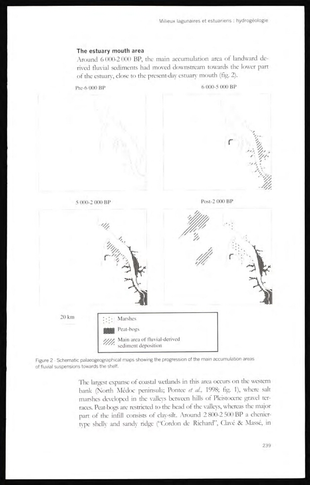
Around 6 000-2 000 BP, the main accumulation area of landward derived fluvial sediments had moved downstream towards the lower part
of the estuary, close to the present-day estuary mouth (flg. 2).
Pre-6 000 BP
6 000-5 000 BP
Figure 2 - Schematic palaeogeographical maps showing the progression of the main accumulation areas
of fluvial suspensions towards the shelf.
The largest expanse of coastal wetlands in this area occurs on the westem
bank (North Médoc peninsula; Pontee et al., 1998; fig. 1), where salt
marshes developed in the valleys between hills of Pleistocene gravel terraces. Peat-bogs are restricted to the head of the valleys, whereas the major
part of the infill consists of clay-silt. Around 2 800-2 500 BP a cheniertype shelly and sandy ridge (“Cordon de Richard”, Clavé & Massé, in
239
Around 6 000-2 000 BP, the main accumulation area of landward derived fluvial sediments had moved downstream towards the lower part
of the estuary, close to the present-day estuary mouth (flg. 2).
Pre-6 000 BP
6 000-5 000 BP
Figure 2 - Schematic palaeogeographical maps showing the progression of the main accumulation areas
of fluvial suspensions towards the shelf.
The largest expanse of coastal wetlands in this area occurs on the westem
bank (North Médoc peninsula; Pontee et al., 1998; fig. 1), where salt
marshes developed in the valleys between hills of Pleistocene gravel terraces. Peat-bogs are restricted to the head of the valleys, whereas the major
part of the infill consists of clay-silt. Around 2 800-2 500 BP a cheniertype shelly and sandy ridge (“Cordon de Richard”, Clavé & Massé, in
239