

CoastGIS'99: geomatics and coastal environment
For coastal defence planning purposes, rhe summation of all single
values per flood unit is of high relevance. Table 2 shows the results for
three different flood units (Marienkoog, Wilstermarsch, Kiel) in the study
area. From this, the great heterogenity of the flood units becomes
apparent. The Marienkoog is a sparsely populated, agricultural polder
along the westcoast with a relatively low damage potential (most of the
values are agricultural values). The Wilstermarsch is a relatively large
flood unit (fig. 5), characterized by some urban settlements ancl a relatively high number of industrial enterprises. This flood unit is special
in that it has no second dyke-line. Furthermore, a large part of the
Wilstermarsch is situatecl well below GOD. In the case of a dyke-breach,
a large lake would appear and remain for a longer time period after the
storm surge. The costs for reparation normally increase with the duration of the (saltwater) flooding. As a result, damages would be specifically high in this flooding unit. The third example shown in table 2
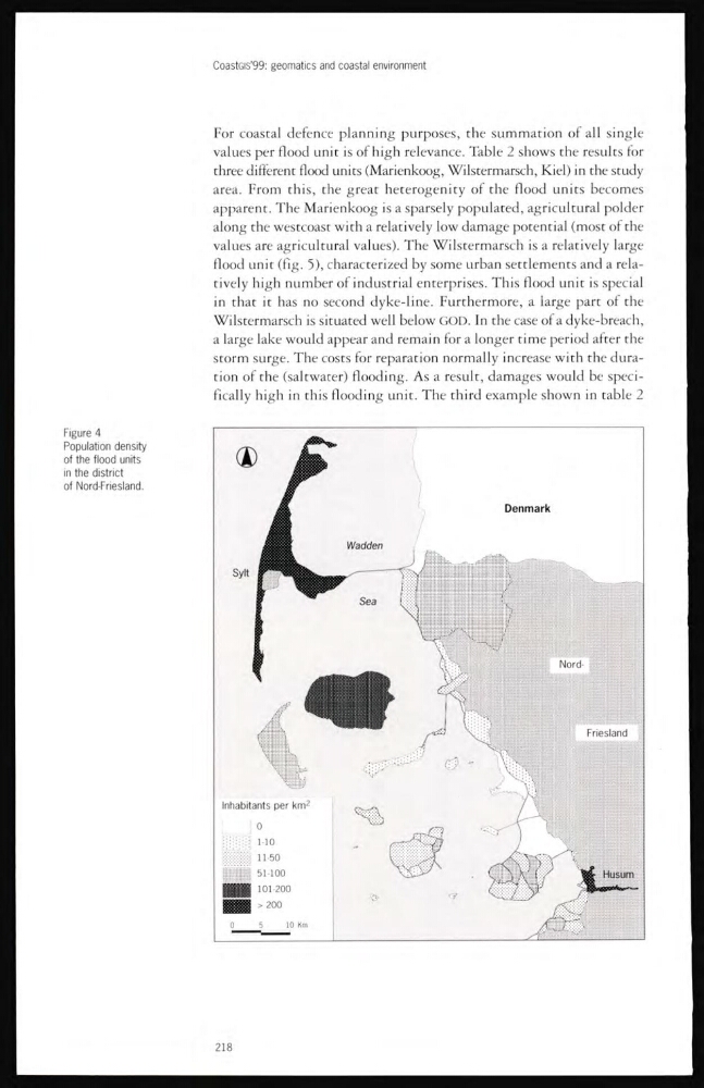
Figure 4
Population density
of the flood units
in the district
of Nord-Friesland.
218
For coastal defence planning purposes, rhe summation of all single
values per flood unit is of high relevance. Table 2 shows the results for
three different flood units (Marienkoog, Wilstermarsch, Kiel) in the study
area. From this, the great heterogenity of the flood units becomes
apparent. The Marienkoog is a sparsely populated, agricultural polder
along the westcoast with a relatively low damage potential (most of the
values are agricultural values). The Wilstermarsch is a relatively large
flood unit (fig. 5), characterized by some urban settlements ancl a relatively high number of industrial enterprises. This flood unit is special
in that it has no second dyke-line. Furthermore, a large part of the
Wilstermarsch is situatecl well below GOD. In the case of a dyke-breach,
a large lake would appear and remain for a longer time period after the
storm surge. The costs for reparation normally increase with the duration of the (saltwater) flooding. As a result, damages would be specifically high in this flooding unit. The third example shown in table 2
Figure 4
Population density
of the flood units
in the district
of Nord-Friesland.
218