

CoastGIS’99: geomatics and coastal environment
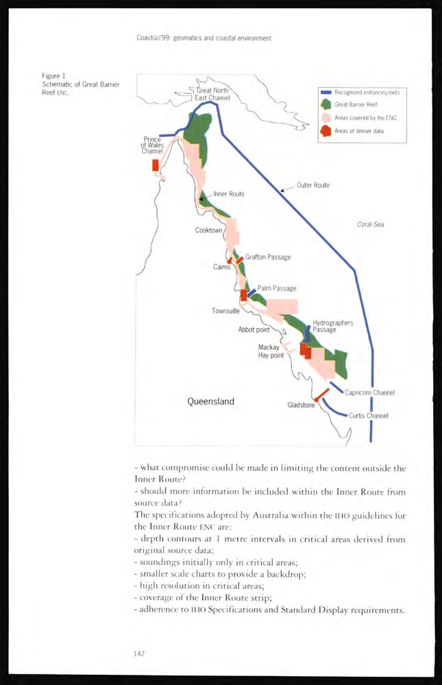
Figure 1
Schematic of Great Barrier
Reef ENC.
- what compromise could be made in limiting the content outside the
lnner Route?
- should more information be included within the Inner Route from
source data?
The specifications adopted by Australia within the IHO guidelines for
the Inner Route ENC are:
- depth contours at 1 metre intervals in critical areas derived from
original source data;
- soundings initially only in critical areas;
- smaller scale charts to provide a backdrop;
- high resolution in critical areas;
- coverage of the Inner Route strip;
- adherence to IHO Specifications and Standard Display requirements.
142
Figure 1
Schematic of Great Barrier
Reef ENC.
- what compromise could be made in limiting the content outside the
lnner Route?
- should more information be included within the Inner Route from
source data?
The specifications adopted by Australia within the IHO guidelines for
the Inner Route ENC are:
- depth contours at 1 metre intervals in critical areas derived from
original source data;
- soundings initially only in critical areas;
- smaller scale charts to provide a backdrop;
- high resolution in critical areas;
- coverage of the Inner Route strip;
- adherence to IHO Specifications and Standard Display requirements.
142