

CoastGIS’99: geomatics and coastal environment
Owens, 1 994). The use of common definitions and a common classification enables the immediate and direct use of the data by both organizations and by others sharing the semantics, even if the systems have
different data structures or different GIS softwares. A portion of the
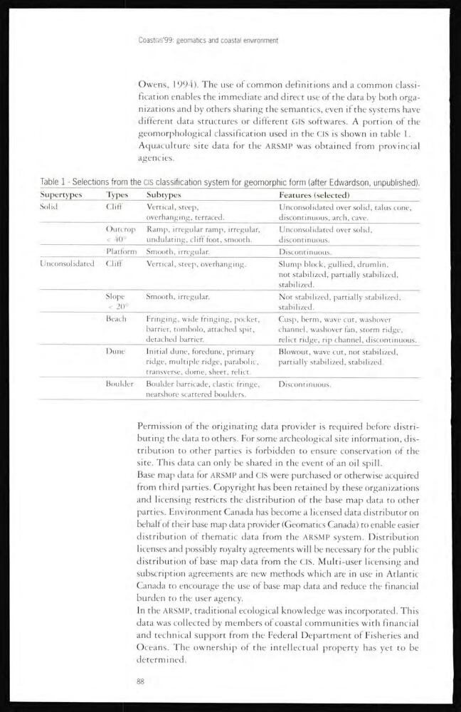
geomorphological classification used in the CIS is shown in table 1.
Aquaculture site data for the ARSMP was obtained from provincial
agencies.
Table 1 - Selections from the CIS classification system for geomorphic form (after Edwardson, unpublished).
Supertypes
Types
Subtypes
Features (selected)
Solid
Cliff
Vertical, steep,
overhanging, terraced.
Unconsolidated over solid, talus cone,
discontinuous, arch, cave.
Outcrop
< 40°
Ramp, irregular ramp, irregular,
undulating, cliff foot, smooth.
Unconsolidated over solid,
discontinuous.
Platform Smooth, irregular.
Discontinuous.
Unconsolidated Cliff
Vertical, steep, overhanging.
Slump block, gullied, drumlin,
not stabilized, partially stabilized,
stabilized.
Slope
< 20°
Smooth, irregular.
Not stabilized, partially stabilized,
stabilized.
Beach
Fringing, wide fringing, pocket,
barrier, tombolo, attached spit,
detached barrier.
Cusp, berm, wave cut, washover
channel, washover fan, storm ridge,
relict ridge, rip channel, discontinuous.
Dune
Initial dune, foredune, primary
ridge, multiple ridge, parabolic,
transverse, dome, sheet, relict.
Blowout, wave cut, not stabilized,
partially stabilized, stabilized.
Boulder
Boulder barricade, clastic fringe,
nearshore scattered boulders.
Discontinuous.
Permission of the originating data provider is required before clistributing the data to others. For some archeological site information, distribution to other parties is forbidden to ensure conservation of the
site. This data can only be shared in the event of an oil spill.
Base map data for ARSMP and CIS were purchased or otherwise acquired
from third parties. Copyright has been retained by these organizations
and licensing restricts the distribution of the base map data to other
parties. Environment Canada has become a licensed data distributor on
behalf of their base map data provider (Geomatics Canada) to enable easier
distribution of thematic data from the ARSMP system. Distribution
licenses and possibly royalty agreements will be necessary for the public
distribution of base map data from the CIS. Multi-user licensing and
subscription agreements are new methods which are in use in Atlantic
Canada to encourage the use of base map data and reduce the financial
burden to the user agency.
In the ARSMP, traditional ecological knowledge was incorporated. This
data was collected by members of coastal communities with financial
and technical support from the Federal Department of Fisheries and
Oceans. The ownership of the intellectual property has yet to be
determined.
88
Owens, 1 994). The use of common definitions and a common classification enables the immediate and direct use of the data by both organizations and by others sharing the semantics, even if the systems have
different data structures or different GIS softwares. A portion of the
geomorphological classification used in the CIS is shown in table 1.
Aquaculture site data for the ARSMP was obtained from provincial
agencies.
Table 1 - Selections from the CIS classification system for geomorphic form (after Edwardson, unpublished).
Supertypes
Types
Subtypes
Features (selected)
Solid
Cliff
Vertical, steep,
overhanging, terraced.
Unconsolidated over solid, talus cone,
discontinuous, arch, cave.
Outcrop
< 40°
Ramp, irregular ramp, irregular,
undulating, cliff foot, smooth.
Unconsolidated over solid,
discontinuous.
Platform Smooth, irregular.
Discontinuous.
Unconsolidated Cliff
Vertical, steep, overhanging.
Slump block, gullied, drumlin,
not stabilized, partially stabilized,
stabilized.
Slope
< 20°
Smooth, irregular.
Not stabilized, partially stabilized,
stabilized.
Beach
Fringing, wide fringing, pocket,
barrier, tombolo, attached spit,
detached barrier.
Cusp, berm, wave cut, washover
channel, washover fan, storm ridge,
relict ridge, rip channel, discontinuous.
Dune
Initial dune, foredune, primary
ridge, multiple ridge, parabolic,
transverse, dome, sheet, relict.
Blowout, wave cut, not stabilized,
partially stabilized, stabilized.
Boulder
Boulder barricade, clastic fringe,
nearshore scattered boulders.
Discontinuous.
Permission of the originating data provider is required before clistributing the data to others. For some archeological site information, distribution to other parties is forbidden to ensure conservation of the
site. This data can only be shared in the event of an oil spill.
Base map data for ARSMP and CIS were purchased or otherwise acquired
from third parties. Copyright has been retained by these organizations
and licensing restricts the distribution of the base map data to other
parties. Environment Canada has become a licensed data distributor on
behalf of their base map data provider (Geomatics Canada) to enable easier
distribution of thematic data from the ARSMP system. Distribution
licenses and possibly royalty agreements will be necessary for the public
distribution of base map data from the CIS. Multi-user licensing and
subscription agreements are new methods which are in use in Atlantic
Canada to encourage the use of base map data and reduce the financial
burden to the user agency.
In the ARSMP, traditional ecological knowledge was incorporated. This
data was collected by members of coastal communities with financial
and technical support from the Federal Department of Fisheries and
Oceans. The ownership of the intellectual property has yet to be
determined.
88