

Halosere
Grassland
-St Lawrence, Queensland
Rainfoll 1000 rnrn
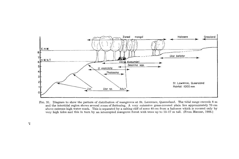
FIG. 31. Diagram to show the pattern of distribution of mangroves at St. Lawrence, Queensland. The tidal range exceeds 8 m
and the intertidal region shows several zones of flattening. A very extensive grass-covered plain lies approximately 75 em
above extreme high water mark. This is separated by a salting cliff of some 40 cm from a halosere which is covered only by
very high tides and this in turn by a n interrupted mangrove forest with trees up to 15-17 m tall. (From Rlacnae, 1966.)
Grassland
-St Lawrence, Queensland
Rainfoll 1000 rnrn
FIG. 31. Diagram to show the pattern of distribution of mangroves at St. Lawrence, Queensland. The tidal range exceeds 8 m
and the intertidal region shows several zones of flattening. A very extensive grass-covered plain lies approximately 75 em
above extreme high water mark. This is separated by a salting cliff of some 40 cm from a halosere which is covered only by
very high tides and this in turn by a n interrupted mangrove forest with trees up to 15-17 m tall. (From Rlacnae, 1966.)