

1Ό
STANLEY N. DAVIS
Vo//ey wo//
U1U1
Ι ^ Χ Τ Τ Γ + Τ Μ Ι Ι Ν Μ Ι Ι Ι Π Γ Τ ]
wall
196 meters
202 meters
Scale
1km
J
200 meters
I98 meters
&ϊ\=ψ = ΟΆ meters
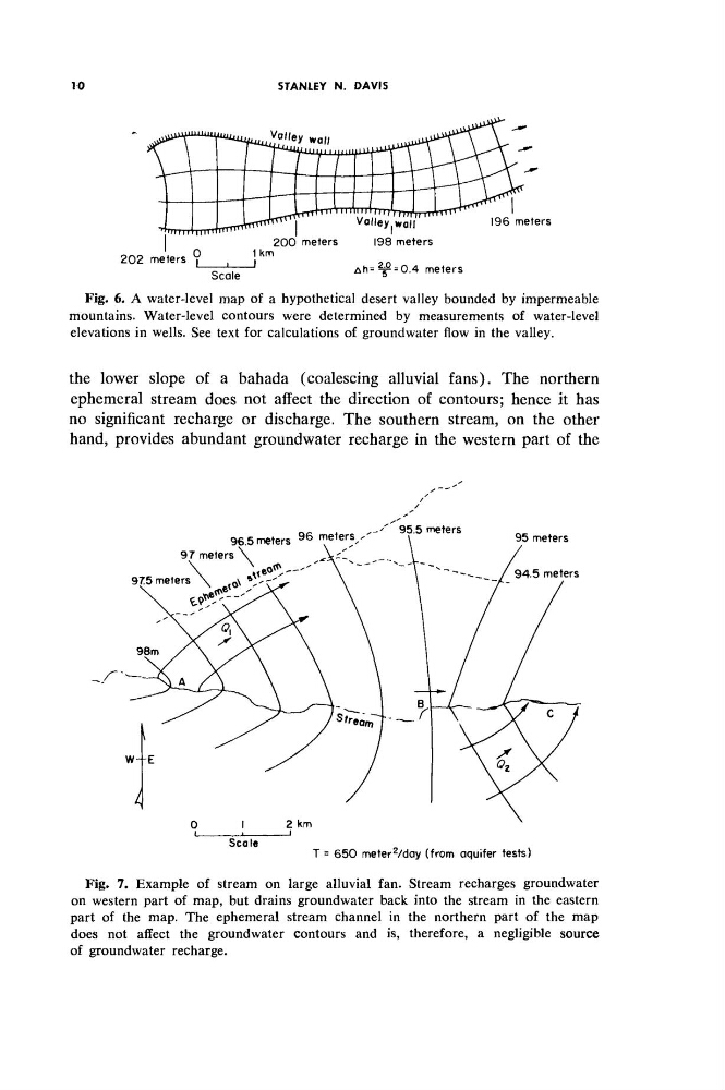
Fig. 6. A water-level map of a hypothetical desert valley bounded by impermeable
mountains. Water-level contours were determined by measurements of water-level
elevations in wells. See text for calculations of groundwater flow in the valley.
the lower slope of a bahada (coalescing alluvial fans). The northern
ephemeral stream does not affect the direction of contours; hence it has
no significant recharge or discharge. The southern stream, on the other
hand, provides abundant groundwater recharge in the western part of the
96.5 meters
9 6 meters^'
95.5 meters
97 meters
975 meters
Scale
T = 650 meter
2
/day (from aquifer tests)
Fig. 7. Example of stream on large alluvial fan. Stream recharges groundwater
on western part of map, but drains groundwater back into the stream in the eastern
part of the map. The ephemeral stream channel in the northern part of the map
does not affect the groundwater contours and is, therefore, a negligible source
of groundwater recharge.
STANLEY N. DAVIS
Vo//ey wo//
U1U1
Ι ^ Χ Τ Τ Γ + Τ Μ Ι Ι Ν Μ Ι Ι Ι Π Γ Τ ]
wall
196 meters
202 meters
Scale
1km
J
200 meters
I98 meters
&ϊ\=ψ = ΟΆ meters
Fig. 6. A water-level map of a hypothetical desert valley bounded by impermeable
mountains. Water-level contours were determined by measurements of water-level
elevations in wells. See text for calculations of groundwater flow in the valley.
the lower slope of a bahada (coalescing alluvial fans). The northern
ephemeral stream does not affect the direction of contours; hence it has
no significant recharge or discharge. The southern stream, on the other
hand, provides abundant groundwater recharge in the western part of the
96.5 meters
9 6 meters^'
95.5 meters
97 meters
975 meters
Scale
T = 650 meter
2
/day (from aquifer tests)
Fig. 7. Example of stream on large alluvial fan. Stream recharges groundwater
on western part of map, but drains groundwater back into the stream in the eastern
part of the map. The ephemeral stream channel in the northern part of the map
does not affect the groundwater contours and is, therefore, a negligible source
of groundwater recharge.