

5.1 INTRODUCTION
131
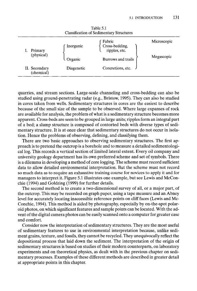
Table 5.1
Classification of Sedimentary Structures
Fabric
Inorganic
Cross-bedding,
I. Primary
ripples, etc.
(physical)
Organic
Burrows and trails
II. Secondary
Diagenetic
Concretions, etc.
(chemical)
Microscopic
Megascopic
quarries, and stream sections. Large-scale channeling and cross-bedding can also be
studied using ground-penetrating radar (e.g., Bristow, 1995). They can also be studied
in cores taken from wells. Sedimentary structures in cores are the easiest to describe
because of the small size of the sample to be observed. Where large expanses of rock
are available for analysis, the problem of what is a sedimentary structure becomes more
apparent. Cross-beds are seen to be grouped in large units; ripples form an integral part
of a bed; a slump structure is composed of contorted beds with diverse types of sedimentary structure. It is at once clear that sedimentary structures do not occur in isolation. Hence the problems of observing, defining, and classifying them.
There are two basic approaches to observing sedimentary structures. The first approach is to pretend the outcrop is a borehole and to measure a detailed sedimentological log. This records a vertical section of limited lateral extent. Every oil company and
university geology department has its own preferred scheme and set of symbols. There
is a dilemma in developing a method of core logging. The scheme must record sufficient
data to allow detailed environmental interpretation. But the scheme must not record
so much data as to require an exhaustive training course for novices to apply it and for
managers to interpret it. Figure 5.1 illustrates one example, but see Lewis and McConchie (1994) and Goldring (1999) for further details.
The second method is to create a two-dimensional survey of all, or a major part, of
the outcrop. This may be recorded on graph paper, using a tape measure and an Abney
level for accurately locating inaccessible reference points on cliff faces (Lewis and McConchie, 1994). This method is aided by photography, especially by on-the-spot polaroid photos, on which significant features and sample points can be located. With the advent of the digital camera photos can be easily scanned onto a computer for greater ease
and comfort.
Consider now the interpretation of sedimentary structures. They are the most useful
of sedimentary features to use in environmental interpretation because, unlike sediment grains, texture, and fossils, they cannot be recycled. They unequivocally reflect the
depositional process that laid down the sediment. The interpretation of the origin of
sedimentary structures is based on studies of their modern counterparts, on laboratory
experiments and on theoretical physics, as dealt with in the previous chapter on sedimentary processes. Examples of these different methods are described in greater detail
at appropriate points in this chapter.
131
Table 5.1
Classification of Sedimentary Structures
Fabric
Inorganic
Cross-bedding,
I. Primary
ripples, etc.
(physical)
Organic
Burrows and trails
II. Secondary
Diagenetic
Concretions, etc.
(chemical)
Microscopic
Megascopic
quarries, and stream sections. Large-scale channeling and cross-bedding can also be
studied using ground-penetrating radar (e.g., Bristow, 1995). They can also be studied
in cores taken from wells. Sedimentary structures in cores are the easiest to describe
because of the small size of the sample to be observed. Where large expanses of rock
are available for analysis, the problem of what is a sedimentary structure becomes more
apparent. Cross-beds are seen to be grouped in large units; ripples form an integral part
of a bed; a slump structure is composed of contorted beds with diverse types of sedimentary structure. It is at once clear that sedimentary structures do not occur in isolation. Hence the problems of observing, defining, and classifying them.
There are two basic approaches to observing sedimentary structures. The first approach is to pretend the outcrop is a borehole and to measure a detailed sedimentological log. This records a vertical section of limited lateral extent. Every oil company and
university geology department has its own preferred scheme and set of symbols. There
is a dilemma in developing a method of core logging. The scheme must record sufficient
data to allow detailed environmental interpretation. But the scheme must not record
so much data as to require an exhaustive training course for novices to apply it and for
managers to interpret it. Figure 5.1 illustrates one example, but see Lewis and McConchie (1994) and Goldring (1999) for further details.
The second method is to create a two-dimensional survey of all, or a major part, of
the outcrop. This may be recorded on graph paper, using a tape measure and an Abney
level for accurately locating inaccessible reference points on cliff faces (Lewis and McConchie, 1994). This method is aided by photography, especially by on-the-spot polaroid photos, on which significant features and sample points can be located. With the advent of the digital camera photos can be easily scanned onto a computer for greater ease
and comfort.
Consider now the interpretation of sedimentary structures. They are the most useful
of sedimentary features to use in environmental interpretation because, unlike sediment grains, texture, and fossils, they cannot be recycled. They unequivocally reflect the
depositional process that laid down the sediment. The interpretation of the origin of
sedimentary structures is based on studies of their modern counterparts, on laboratory
experiments and on theoretical physics, as dealt with in the previous chapter on sedimentary processes. Examples of these different methods are described in greater detail
at appropriate points in this chapter.